File:La Soufriere Delineation Map.jpg

Original file (4,677 × 6,623 pixels, file size: 3.17 MB, MIME type: image/jpeg)
Captions
Captions
Summary edit
| Description |
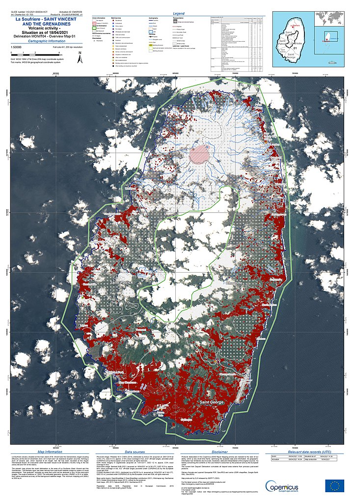
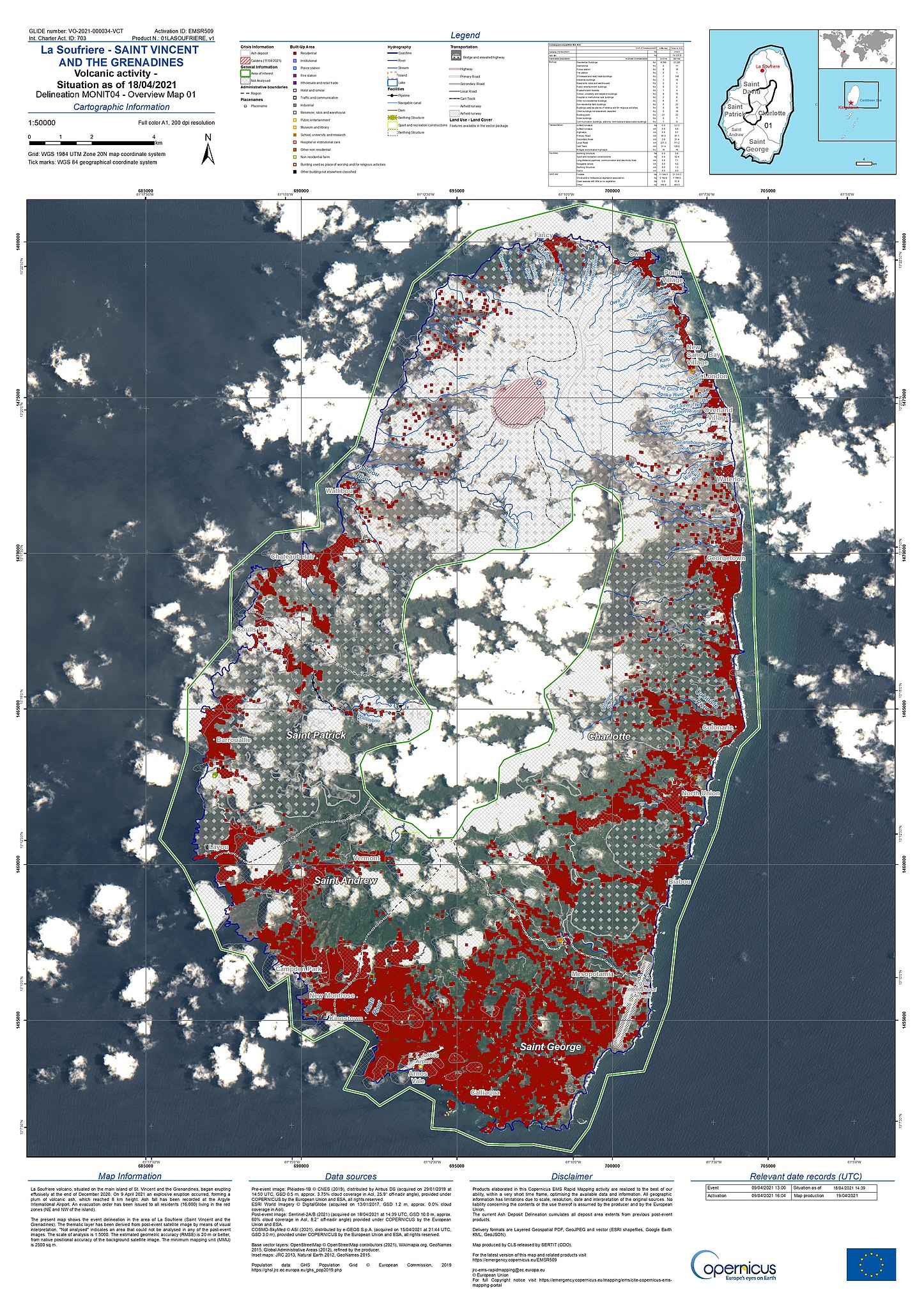
English: EMSR509 AOI01 DEL MONIT04 r1 RTP01 v1 |
| Date | |
| Source | https://emergency.copernicus.eu/mapping/ems-product-component/EMSR509_AOI01_DEL_MONIT04_r1_RTP01/1 |
| Author | Copernicus Mapping |
Licensing edit

|
This image contains data from a satellite in the Copernicus Programme, such as Sentinel-1, Sentinel-2 or Sentinel-3. Attribution is required when using this image.
Attribution: Contains modified Copernicus Sentinel data {{{year}}}
The use of Copernicus Sentinel Data is regulated under EU law (Commission Delegated Regulation (EU) No 1159/2013 and Regulation (EU) No 377/2014). Relevant excerpts:
Free access shall be given to GMES dedicated data [...] made available through GMES dissemination platforms [...].
Access to GMES dedicated data [...] shall be given for the purpose of the following use in so far as it is lawful:
GMES dedicated data [...] may be used worldwide without limitations in time.
GMES dedicated data and GMES service information are provided to users without any express or implied warranty, including as regards quality and suitability for any purpose. |
File history
Click on a date/time to view the file as it appeared at that time.
| Date/Time | Thumbnail | Dimensions | User | Comment | |
|---|---|---|---|---|---|
| current | 20:26, 21 April 2021 | | 4,677 × 6,623 (3.17 MB) | Zoozaz1 (talk | contribs) | Uploaded a work by Copernicus Mapping from https://emergency.copernicus.eu/mapping/ems-product-component/EMSR509_AOI01_DEL_MONIT04_r1_RTP01/1 with UploadWizard |
You cannot overwrite this file.
File usage on Commons
There are no pages that use this file.