File:Lac Teiocha-Rontiong, dit communement Lac Érié.jpg

Size of this preview: 800 × 506 pixels. Other resolutions: 320 × 202 pixels | 640 × 405 pixels | 1,024 × 647 pixels | 1,280 × 809 pixels | 2,560 × 1,618 pixels | 6,072 × 3,838 pixels.
Original file (6,072 × 3,838 pixels, file size: 4.29 MB, MIME type: image/jpeg)
Captions
Captions
Add a one-line explanation of what this file represents
Summary edit
| Description |
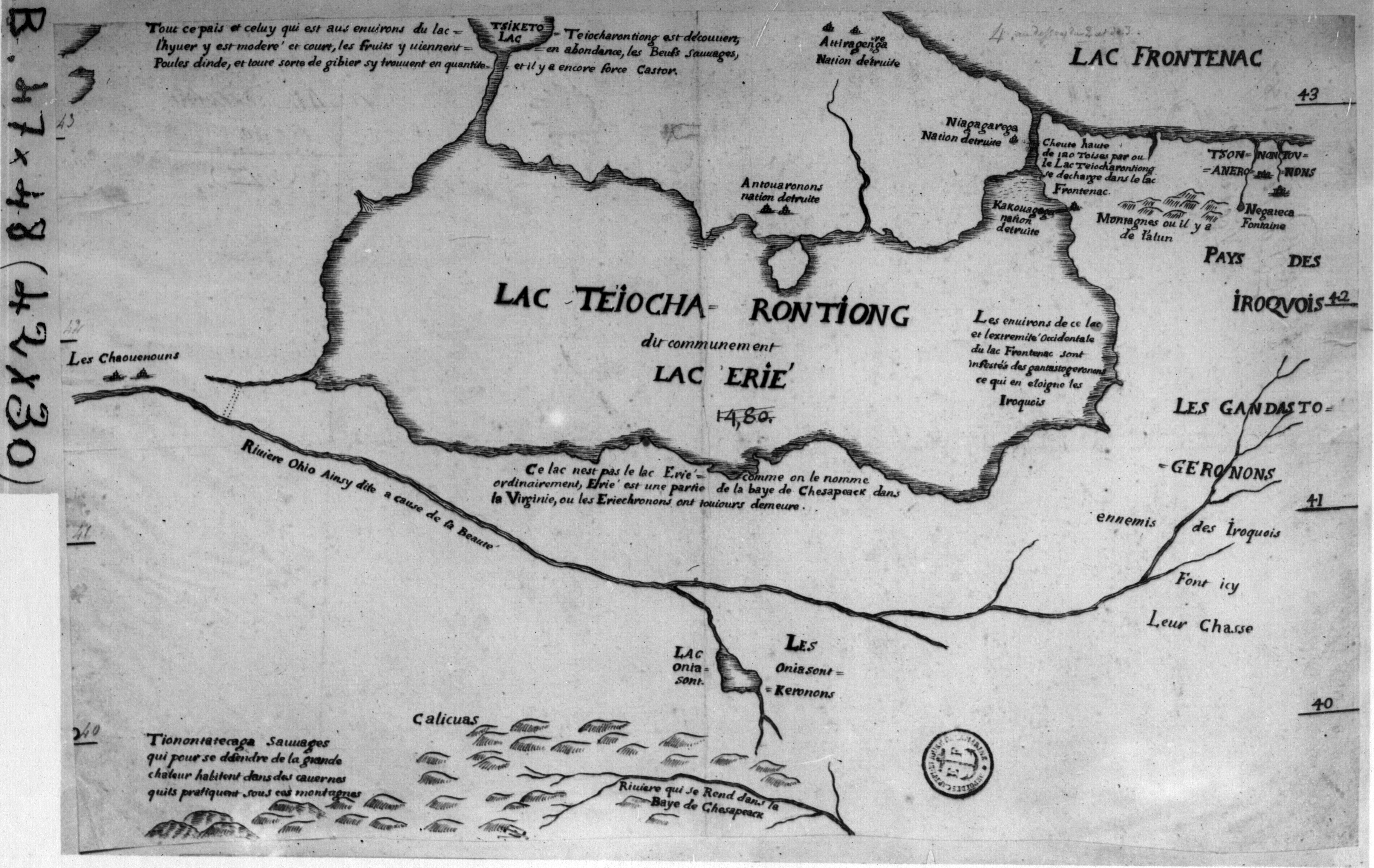
Français : Lac Teiocharontiong, dit communement Lac Érié. On y voit aussi l'emplacement de la nation détruite Niagagarega; chute haute de 120 toises par où le lac Teiocharontiong se décharge dans le lac Frontenac. |
| Date | |
| Source |
http://rla.unc.edu/Mapfiles/HMC2/BSH%20B%204044-48.HMC.2.jpg http://carljweber.com/EMAS1650-1699.html |
| Author | Anonymous [Bernou, Claude?] |
| Camera location | | View this and other nearby images on: OpenStreetMap |
|---|
Licensing edit
|
This work is in the public domain in its country of origin and other countries and areas where the copyright term is the author's life plus 70 years or fewer. This work is in the public domain in the United States because it was published (or registered with the U.S. Copyright Office) before January 1, 1929. | |
| This file has been identified as being free of known restrictions under copyright law, including all related and neighboring rights. | |
File history
Click on a date/time to view the file as it appeared at that time.
| Date/Time | Thumbnail | Dimensions | User | Comment | |
|---|---|---|---|---|---|
| current | 02:14, 23 August 2019 | | 6,072 × 3,838 (4.29 MB) | Pierre5018 (talk | contribs) | User created page with UploadWizard |
You cannot overwrite this file.
File usage on Commons
There are no pages that use this file.
File usage on other wikis
The following other wikis use this file:
- Usage on fr.wikipedia.org