File:Lage Dschabal Sindschar.png
Size of this preview: 722 × 599 pixels. Other resolutions: 289 × 240 pixels | 578 × 480 pixels | 836 × 694 pixels.
Original file (836 × 694 pixels, file size: 640 KB, MIME type: image/png)
Captions
Captions
Add a one-line explanation of what this file represents
Summary edit
| Description |
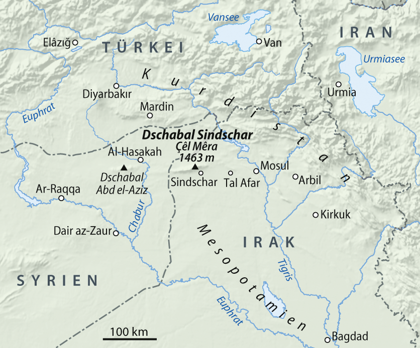
Deutsch: Übersichtskarte der Lage des Dschabal Sindschar
English: General map of the location of the Sinjar Mountains |
|
| Date | ||
| Source |
Own work, using
|
|
| Author | NordNordWest | |
| Permission (Reusing this file) |
This file is licensed under the Creative Commons Attribution-Share Alike 3.0 Germany license.
 This file is licensed under the Creative Commons Attribution-Share Alike 3.0 Germany license.
|


|
This map has been made or improved in the German Kartenwerkstatt (Map Lab). You can propose maps to improve as well.
|
File history
Click on a date/time to view the file as it appeared at that time.
| Date/Time | Thumbnail | Dimensions | User | Comment | |
|---|---|---|---|---|---|
| current | 10:02, 22 December 2009 | | 836 × 694 (640 KB) | NordNordWest (talk | contribs) | |
| 09:56, 22 December 2009 |  | 836 × 694 (674 KB) | NordNordWest (talk | contribs) | == {{int:filedesc}} == {{Information |Description= {{de|Übersichtskarte der Lage des Dschabal Sindschar}} {{en|General map of the location of the Sinjar Mountains}} |Source={{Own}}, using * GTOPO-30 El |
You cannot overwrite this file.
File usage on Commons
The following page uses this file:
File usage on other wikis
The following other wikis use this file:
- Usage on ckb.wikipedia.org
- Usage on de.wikipedia.org
- Usage on no.wikipedia.org
- Usage on uk.wikipedia.org