File:Lage der kreisfreien Stadt Greifswald in Deutschland.png
No higher resolution available.
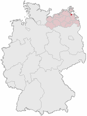
Lage_der_kreisfreien_Stadt_Greifswald_in_Deutschland.png (176 × 234 pixels, file size: 3 KB, MIME type: image/png)
Captions
Captions
Add a one-line explanation of what this file represents
Karte erstellt auf der Grundlage der opengeodb.de-Umrisse

|
Permission is granted to copy, distribute and/or modify this document under the terms of the GNU Free Documentation License, Version 1.2 or any later version published by the Free Software Foundation; with no Invariant Sections, no Front-Cover Texts, and no Back-Cover Texts. A copy of the license is included in the section entitled GNU Free Documentation License. |
| This file is licensed under the Creative Commons Attribution-Share Alike 3.0 Unported license. | ||
| ||
| This licensing tag was added to this file as part of the GFDL licensing update. |
File history
Click on a date/time to view the file as it appeared at that time.
| Date/Time | Thumbnail | Dimensions | User | Comment | |
|---|---|---|---|---|---|
| current | 13:42, 3 August 2006 | | 176 × 234 (3 KB) | Conscious (talk | contribs) | Reverted to earlier revision |
| 13:42, 3 August 2006 |  | 188 × 235 (5 KB) | Conscious (talk | contribs) | version from en: | |
| 02:45, 8 March 2006 |  | 176 × 234 (3 KB) | Rauenstein (talk | contribs) | Karte erstellt auf der Grundlage der opengeodb.de-Umrisse {{Bild-GFDL}} Category:Location maps of Mecklenburg-Western Pomerania |
You cannot overwrite this file.
File usage on Commons
The following page uses this file:
File usage on other wikis
The following other wikis use this file:
- Usage on af.wikipedia.org
- Usage on azb.wikipedia.org
- Usage on de.wikinews.org
- Usage on eo.wikipedia.org
- Usage on id.wikipedia.org
- Usage on is.wikipedia.org
- Usage on ja.wikipedia.org
- Usage on ko.wikipedia.org
- Usage on pl.wikivoyage.org
- Usage on sl.wikipedia.org