File:Lage des Schwelmer Eisenwerks in Schwelm 1947.jpg
Size of this preview: 800 × 494 pixels. Other resolutions: 320 × 197 pixels | 640 × 395 pixels | 1,024 × 632 pixels | 1,280 × 790 pixels | 2,755 × 1,700 pixels.
Original file (2,755 × 1,700 pixels, file size: 1.21 MB, MIME type: image/jpeg)
Captions
Captions
Add a one-line explanation of what this file represents
Summary edit
| Description |
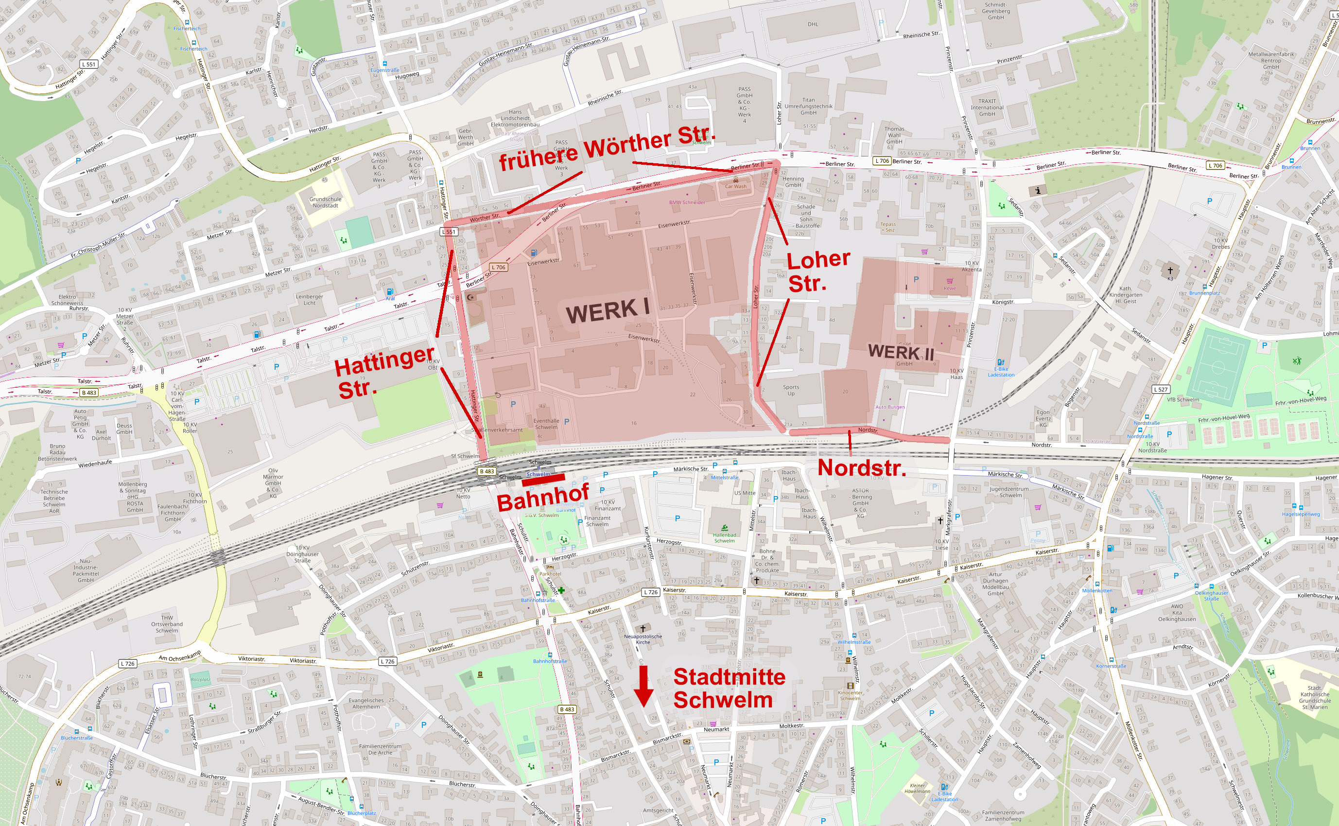
Deutsch: Annähernde Lage des Schwelmer Eisenwerks Müller & Co. in Schwelm im Jahr 1947 (in farbiger Markierung über heutigem Kartenwerk): Werk I zwischen Bahngleisen, Hattinger Straße, Wörther Straße (heute: Berliner Straße) und Loher Straße (Fläche 15,7 ha), Werk II an der Nordstraße (Fläche 4,0 ha). (Alle Flächengrenzen nur angedeutet gemäß Werksplan vom 29. Dezember 1947, entnommen Gutachten Heinrich Paulus, Düsseldorf, 1948). |
| Date | |
| Source | https://www.openstreetmap.org/; Werksarchiv Schwelmer Eisenwerk, Marc Albano-Müller, Schwelm |
| Author | © OpenStreetMap-Mitwirkende; Hannoverscher (Kartenvorlage aus OpenStreetMap wurde vom Hochladenden um farbige Markierungen und Text ergänzt) |
Licensing edit
This file is licensed under the Creative Commons Attribution-Share Alike 4.0 International license.
- You are free:
- to share – to copy, distribute and transmit the work
- to remix – to adapt the work
- Under the following conditions:
- attribution – You must give appropriate credit, provide a link to the license, and indicate if changes were made. You may do so in any reasonable manner, but not in any way that suggests the licensor endorses you or your use.
- share alike – If you remix, transform, or build upon the material, you must distribute your contributions under the same or compatible license as the original.
File history
Click on a date/time to view the file as it appeared at that time.
| Date/Time | Thumbnail | Dimensions | User | Comment | |
|---|---|---|---|---|---|
| current | 08:16, 7 December 2020 | | 2,755 × 1,700 (1.21 MB) | Hannoverscher (talk | contribs) | {{Information |Description={{de|1=Annähernde Lage des Schwelmer Eisenwerks Müller & Co. in Schwelm im Jahr 1947 (in farbiger Markierung über heutiger Kartenvorlage): Werk I zwischen Bahngleisen, Hattinger Straße, Wörther Straße (heute: Berliner Straße) und Loher Straße (Fläche 15,7 ha), Werk II an der Nordstraße (Fläche 4,0 ha). (Alle Flächengrenzen nur angedeutet gemäß Werksplan vom 29. Dezember 1947, entnommen Gutachten Heinrich Paulus, Düsseldorf, 1948).}} |Source=https://www.openstreetmap... |
You cannot overwrite this file.
File usage on Commons
The following page uses this file: