File:Lageplan-Kalischächte-neu.jpg
Size of this preview: 800 × 540 pixels. Other resolutions: 320 × 216 pixels | 640 × 432 pixels | 808 × 545 pixels.
Original file (808 × 545 pixels, file size: 291 KB, MIME type: image/jpeg)
Captions
Captions
Add a one-line explanation of what this file represents
Summary edit
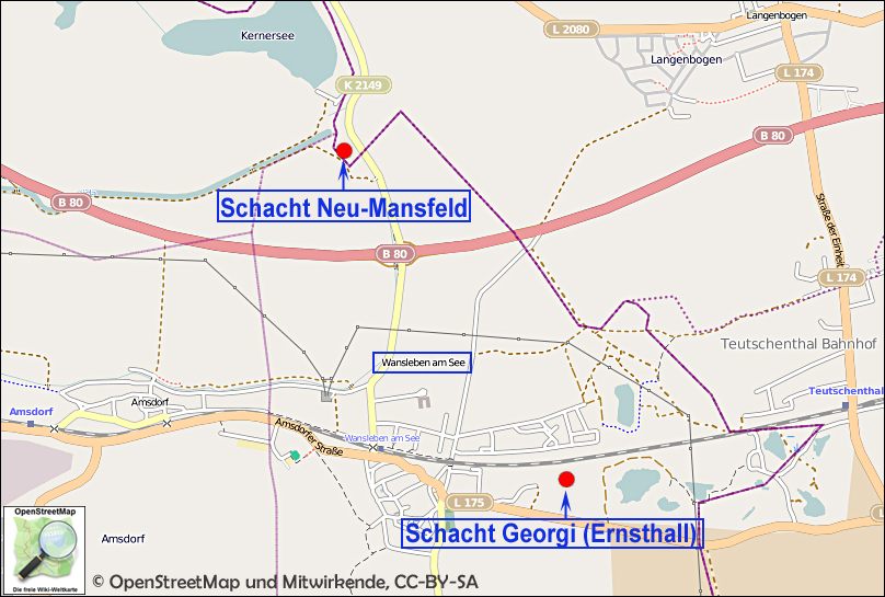
| Description | Lage der Schächte Ernsthall und Neu-Mansfeld |
| Date | |
| Source | Eigenes Werk auf Basis OpenStreetMap |
| Author | Dr. Günter Pinzke |
Licensing edit
This file is licensed under the Creative Commons Attribution-Share Alike 2.0 Generic license.
- You are free:
- to share – to copy, distribute and transmit the work
- to remix – to adapt the work
- Under the following conditions:
- attribution – You must give appropriate credit, provide a link to the license, and indicate if changes were made. You may do so in any reasonable manner, but not in any way that suggests the licensor endorses you or your use.
- share alike – If you remix, transform, or build upon the material, you must distribute your contributions under the same or compatible license as the original.
File history
Click on a date/time to view the file as it appeared at that time.
| Date/Time | Thumbnail | Dimensions | User | Comment | |
|---|---|---|---|---|---|
| current | 08:54, 2 February 2012 | | 808 × 545 (291 KB) | Berginspektor (talk | contribs) | {{Information |Description=Lage der Schächte Ernsthall und Neu-Mansfeld |Source=Eigenes Werk auf Basis OpenStreetMap |Date=2012 |Author=Dr. Günter Pinzke |Permission= |other_versions= }} Category:Historical mines [[Category:History of Saxony-Anhalt] |
You cannot overwrite this file.
File usage on Commons
There are no pages that use this file.
File usage on other wikis
The following other wikis use this file:
- Usage on de.wikipedia.org