File:Lageplan-aus-1852.jpg
Size of this preview: 470 × 600 pixels. Other resolutions: 188 × 240 pixels | 376 × 480 pixels | 602 × 768 pixels | 803 × 1,024 pixels | 1,280 × 1,633 pixels.
Original file (1,280 × 1,633 pixels, file size: 755 KB, MIME type: image/jpeg)
Captions
Captions
Add a one-line explanation of what this file represents
Summary edit
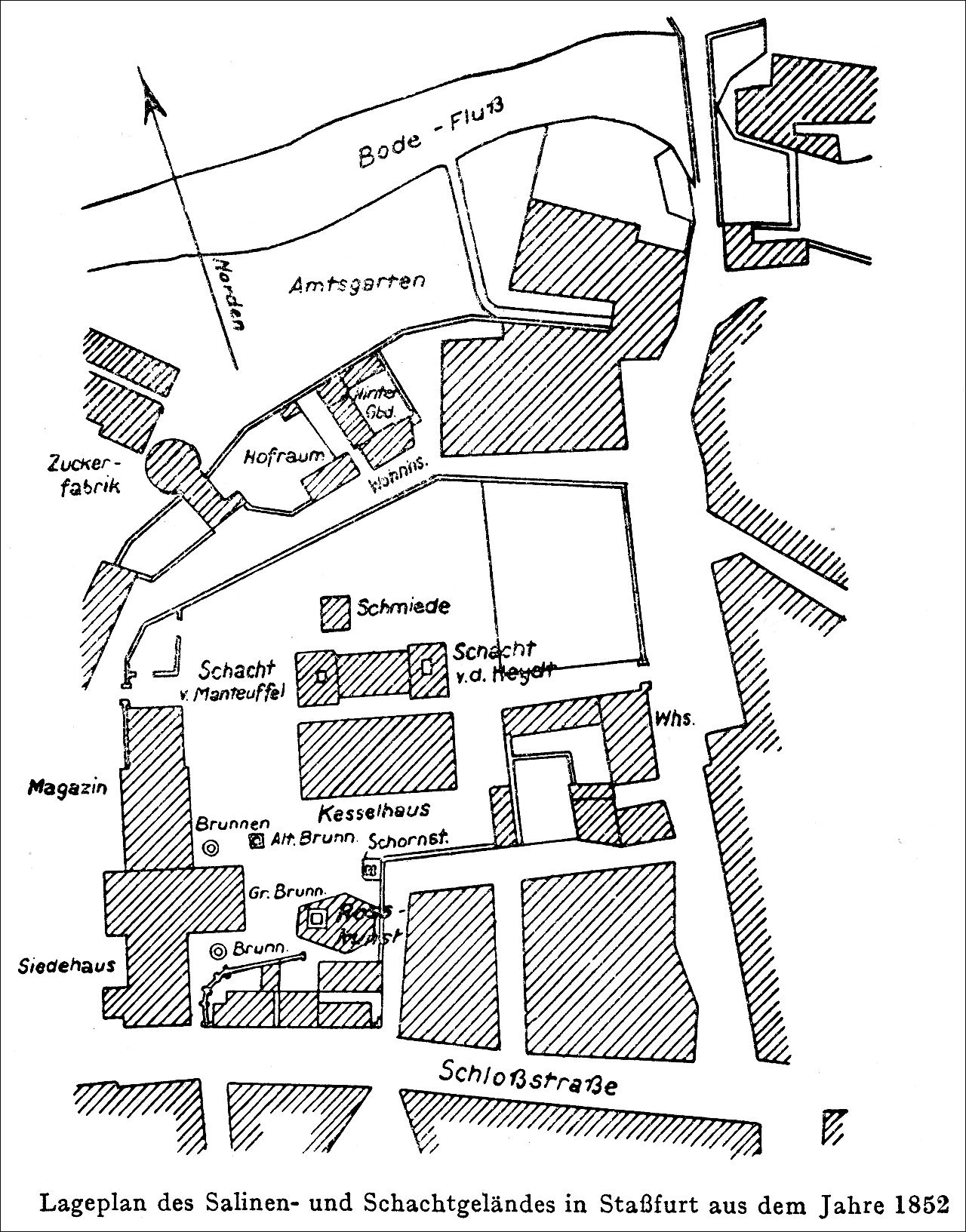
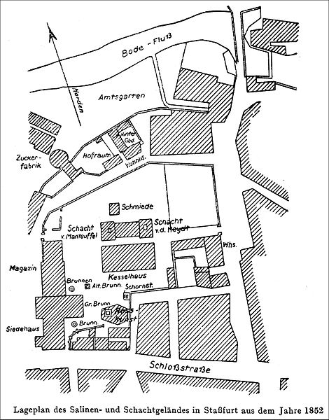
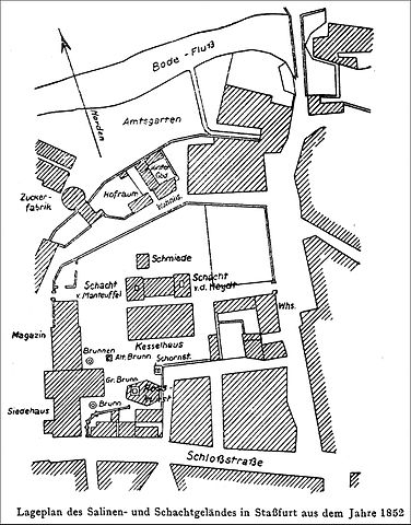
| Description | Lageplan der Staßfurter Saline von anno 1852. |
| Date | / 1952 / 2015 |
| Source | "HUNDERT JAHRE STASSFURTER SALZBERGBAU", Anhang zu der anläßlich der Hundertjahrfeier vom Kaliwerk Staßfurt am Tage des Bergmannes 1952 herausgegebenen Festschrift, Kaliwerk Staßfurt (VEB), Staßfurt 1952, Seite 17. |
| Author | Unbekannt. Recherche:Dr. Günter Pinzke |
Licensing edit

|
The copyright holder of this work allows anyone to use it for any purpose including unrestricted redistribution, commercial use, and modification.
Usage notes:
|
File history
Click on a date/time to view the file as it appeared at that time.
| Date/Time | Thumbnail | Dimensions | User | Comment | |
|---|---|---|---|---|---|
| current | 14:46, 2 August 2015 | | 1,280 × 1,633 (755 KB) | Berginspektor (talk | contribs) | {{Information |Description=Lageplan der Staßfurter Saline von anno 1852. |Source="HUNDERT JAHRE STASSFURTER SALZBERGBAU", Anhang zu der anläßlich der Hundertjahrfeier vom Kaliwerk Staßfurt am Tage des Bergmannes 1952 herausgegebenen Festschrift, Ka... |
You cannot overwrite this file.
File usage on Commons
There are no pages that use this file.
File usage on other wikis
The following other wikis use this file:
- Usage on de.wikipedia.org