File:Lake El'gygytgyn Russia lansat 7 image.gif

Size of this preview: 633 × 600 pixels. Other resolutions: 253 × 240 pixels | 507 × 480 pixels | 810 × 768 pixels | 1,081 × 1,024 pixels | 1,508 × 1,429 pixels.
Original file (1,508 × 1,429 pixels, file size: 1.19 MB, MIME type: image/gif, 0.0 s)
Captions
Captions
Add a one-line explanation of what this file represents
Summary edit
| Description |
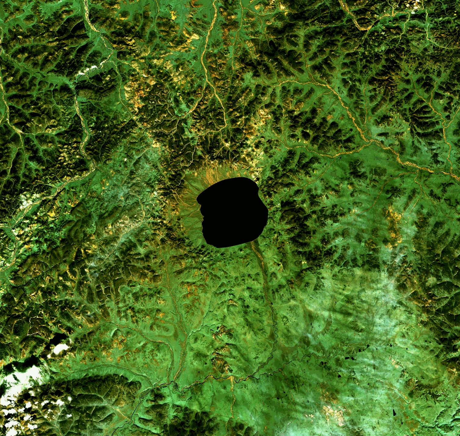
Русский: Изображение кратера Эльгыгытгын, спутник Landsat 7. полосы 3, 2, 1. На изображении отчетливо прослеживается вал, окружающий озеро. Кратер окружает слабо выраженная кольцевая структура диаметром около 30 км..
English: Landsat 7 image of Lake El'gygytgyn (Russian Эльгыгытгын) is an impact crater lake located in the Chukotka Autonomous Okrug in north-east Siberia, about 150km southeast of Chaunskaya Bay. |
| Date | Unknown date |
| Source | http://www.meteorites.ru/images/ruscraters/full/ruscraters19.gif |
| Author | NASA |
Licensing edit
| This file is in the public domain in the United States because it was solely created by NASA. NASA copyright policy states that "NASA material is not protected by copyright unless noted". (See Template:PD-USGov, NASA copyright policy page or JPL Image Use Policy.) | ||
 |
Warnings:
|
File history
Click on a date/time to view the file as it appeared at that time.
| Date/Time | Thumbnail | Dimensions | User | Comment | |
|---|---|---|---|---|---|
| current | 19:21, 2 June 2010 | | 1,508 × 1,429 (1.19 MB) | JukoFF (talk | contribs) | == Summary == {{Information |Description={{ru|1= Изображение кратера Эльгыгытгын, спутник Landsat 7. полосы 3, 2, 1. На изображении отчетливо прослеживается вал, окружа |
You cannot overwrite this file.
File usage on Commons
There are no pages that use this file.
File usage on other wikis
The following other wikis use this file:
- Usage on ru.wikipedia.org