File:Lake sakakawea.jpg
Size of this preview: 607 × 600 pixels. Other resolutions: 243 × 240 pixels | 486 × 480 pixels | 778 × 768 pixels | 1,037 × 1,024 pixels | 2,073 × 2,048 pixels | 3,904 × 3,856 pixels.
Original file (3,904 × 3,856 pixels, file size: 6.91 MB, MIME type: image/jpeg)
Captions
Captions
Add a one-line explanation of what this file represents
Summary edit
| Description |
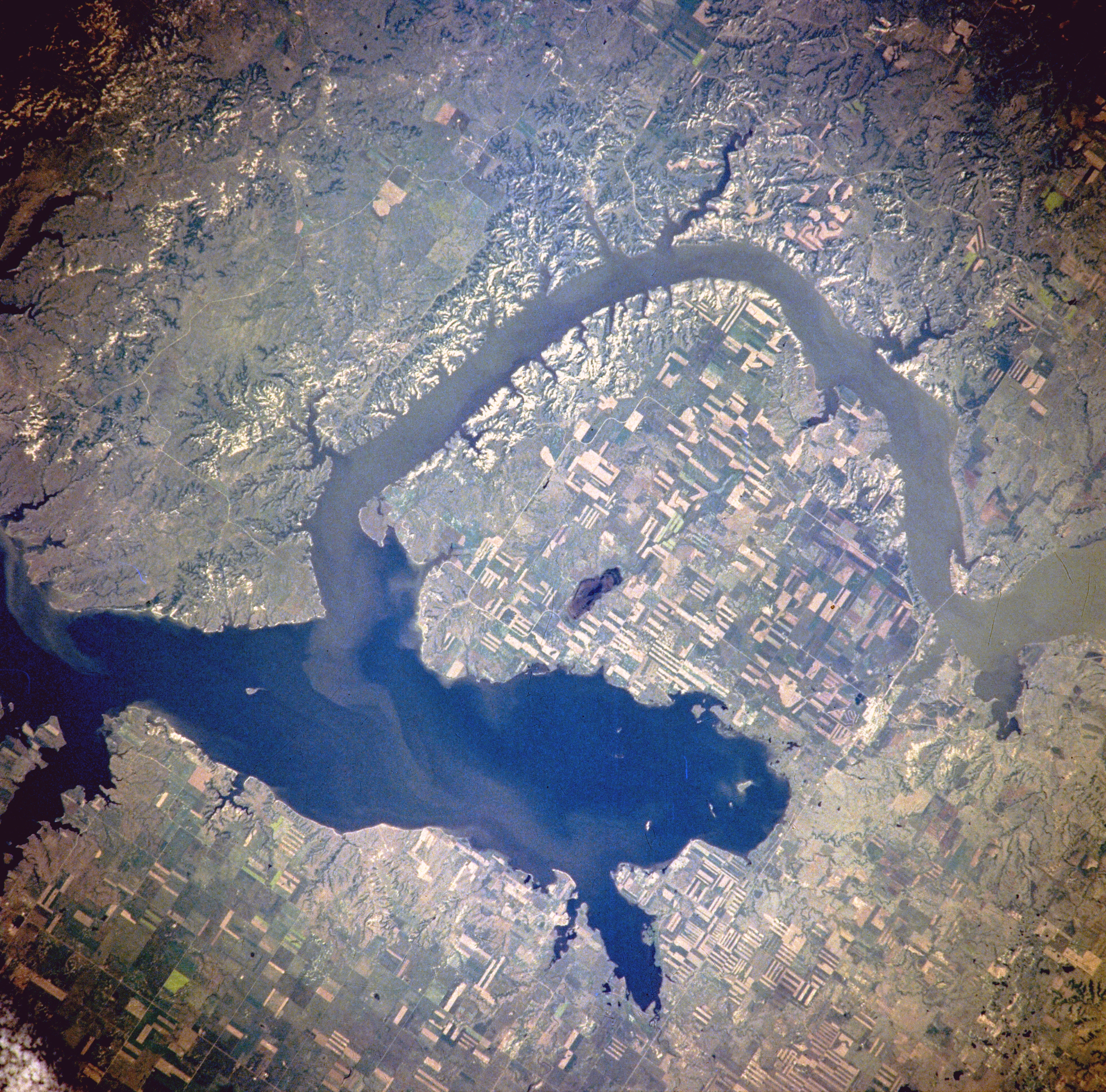
Van Hook Arm of Lake Sakakawea, North Dakota, United States - Satellite image, July 1996 The image description can be found here. The bridge on the right holds North Dakota Highway 23. North is to the right side of the image.[1] |
| Date | |
| Source | http://eol.jsc.nasa.gov/sseop/EFS/photoinfo.pl?PHOTO=NM21-765-97 |
| Author | NASA |
| Permission (Reusing this file) |
PD-LAYOUT; PD-USGOV-NASA. |
Licensing edit
| This file is in the public domain in the United States because it was solely created by NASA. NASA copyright policy states that "NASA material is not protected by copyright unless noted". (See Template:PD-USGov, NASA copyright policy page or JPL Image Use Policy.) | ||
 |
Warnings:
|
Original upload log edit
(All user names refer to en.wikipedia)
- 2005-08-06 21:16 Darwinek 639×632×8 (196210 bytes)
Originally from en.wikipedia; description page is/was here.
File history
Click on a date/time to view the file as it appeared at that time.
| Date/Time | Thumbnail | Dimensions | User | Comment | |
|---|---|---|---|---|---|
| current | 18:31, 27 February 2012 | | 3,904 × 3,856 (6.91 MB) | Ras67 (talk | contribs) | high resolution |
| 13:41, 4 August 2007 |  | 639 × 632 (192 KB) | Matthiasb (talk | contribs) | {{Information |Description=Van Hook Arm of Lake Sakakawea, North Dakota, United States - July 1996 The image description can be found [http://eol.jsc.nasa.gov/sseop/EFS/photoinfo.pl?PHOTO=NM21-765-97 here]. North is to the right side of the image.[http: |
You cannot overwrite this file.
File usage on Commons
The following page uses this file:
File usage on other wikis
The following other wikis use this file:
- Usage on azb.wikipedia.org
- Usage on ceb.wikipedia.org
- Usage on de.wikipedia.org
- Usage on en.wikipedia.org
- Usage on es.wikipedia.org
- Usage on fa.wikipedia.org
- Usage on fr.wikipedia.org
- Usage on it.wikipedia.org
- Usage on ru.wikipedia.org
- Usage on sr.wikipedia.org
- Usage on te.wikipedia.org
- Usage on www.wikidata.org
- Usage on zh.wikipedia.org