File:Lake syunkusitakara landsat.jpg
Size of this preview: 577 × 600 pixels. Other resolutions: 231 × 240 pixels | 462 × 480 pixels | 739 × 768 pixels | 1,024 × 1,064 pixels.
Original file (1,024 × 1,064 pixels, file size: 643 KB, MIME type: image/jpeg)
Captions
Captions
Add a one-line explanation of what this file represents
Summary
| Description |
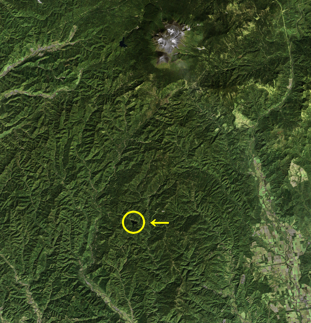
English: Landsat image of Lake Syunkusitakara at Hokkaido, Japan (in the yellow circle). We can see Mt. Meakan and Mt. Akan-Fuji in the upper part of this image.
日本語: シュンクシタカラ湖のランドサット画像。黄色の円内に湖があるのが分かる。この湖は1970年代に、人工衛星によってその存在が確認されている。周囲には山林が広がり、無人地帯となっていることがわかる。なお、画面上方には、雌阿寒岳と阿寒富士の山塊が見えている。 |
| Date | |
| Source | Landsat Image |
| Author | Tdk |
| The Landsat satellite data used for this image came from Global Land Cover Facility (GLCF). The 3-D effects are processed with Kashmir 3D. |
Licensing

|
Permission is granted to copy, distribute and/or modify this document under the terms of the GNU Free Documentation License, Version 1.2 or any later version published by the Free Software Foundation; with no Invariant Sections, no Front-Cover Texts, and no Back-Cover Texts. A copy of the license is included in the section entitled GNU Free Documentation License. |
| This file is licensed under the Creative Commons Attribution-Share Alike 3.0 Unported license. | ||
| ||
| This licensing tag was added to this file as part of the GFDL licensing update. |
File history
Click on a date/time to view the file as it appeared at that time.
| Date/Time | Thumbnail | Dimensions | User | Comment | |
|---|---|---|---|---|---|
| current | 08:21, 9 February 2008 | | 1,024 × 1,064 (643 KB) | Tdk~commonswiki (talk | contribs) | {{Information |Description=en:Landsat image of Lake Syunkusitakara at Hokkaido, Japan (in the yellow circle). We can see Mt.Meakan and Mt.Akan-Fuji in the upper part of this image. ja:シュンクシタカラ湖のランドサット画像。黄色の円� |
You cannot overwrite this file.
File usage on Commons
There are no pages that use this file.
File usage on other wikis
The following other wikis use this file:
- Usage on ja.wikipedia.org