File:Landappbw 256552 1824 Kilometerstein Historischer Kilometerstein Hechingen Hechingen.jpg

Size of this preview: 450 × 600 pixels. Other resolutions: 180 × 240 pixels | 360 × 480 pixels | 960 × 1,280 pixels.
Original file (960 × 1,280 pixels, file size: 675 KB, MIME type: image/jpeg)
Captions
Captions
Add a one-line explanation of what this file represents
Summary
edit
| Description |
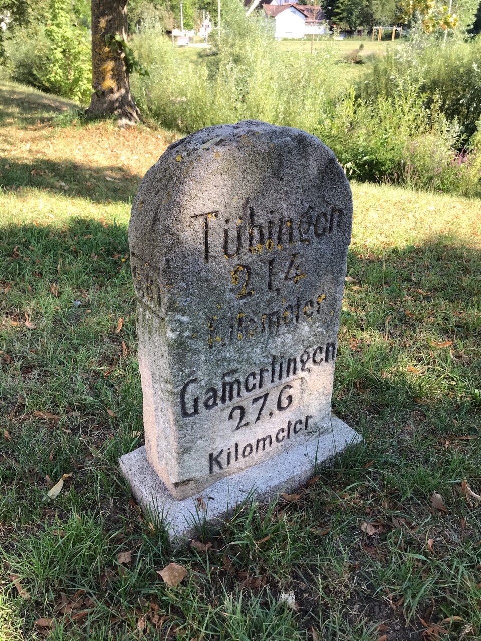
Deutsch: Bisher einziger bekannter Kilometerstein im ehemaligen Hohenzollern. Er stand an der sogenannten Schweizerstraße, welche Stuttgart mit Schaffhausen verband. Außerdem in Ost-West-Richtung Gammertingen und Haigerloch. An der schmalen Seite ist 9,81 eingemeißelt, was bedeutet, dass der Stein 9,81 km vom Nullpunkt entfernt steht. Das war damals die preußisch/württembergische Grenze bei Balingen-Engstlatt.
Der Kilometerstein ist seit dem 14.8.2019 in der Allgemeinen Denkmal-Datenbank des Landes BW mit der Nummer 110938517 als Kulturdenkmal geführt. |
| Date | 13 August 2020, 06:14:19 (original upload date) |
| Source | overview - direct - dataset |
| Author | David |
| Permission (Reusing this file) |
Creative Commons Zero (CC0) |
| ID | 256552 |
| Category | 1830 |
| Object location | | View this and other nearby images on: OpenStreetMap |
|---|
This media file was collected by Landauf, LandApp under the ID 256552. This tag does not indicate the copyright status of the attached work. A normal copyright tag is still required. See Commons:Licensing. |
Licensing
edit
| This file is made available under the Creative Commons CC0 1.0 Universal Public Domain Dedication. | |
| The person who associated a work with this deed has dedicated the work to the public domain by waiving all of their rights to the work worldwide under copyright law, including all related and neighboring rights, to the extent allowed by law. You can copy, modify, distribute and perform the work, even for commercial purposes, all without asking permission.
|
File history
Click on a date/time to view the file as it appeared at that time.
| Date/Time | Thumbnail | Dimensions | User | Comment | |
|---|---|---|---|---|---|
| current | 14:36, 1 May 2023 | | 960 × 1,280 (675 KB) | LaserlichtBot (talk | contribs) | =={{int:filedesc}}== {{Information |description={{de|1=Bisher einziger bekannter Kilometerstein im ehemaligen Hohenzollern. Er stand an der sogenannten Schweizerstraße, welche Stuttgart mit Schaffhausen verband. Außerdem in Ost-West-Richtung Gammertingen und Haigerloch. An der schmalen Seite ist 9,81 eingemeißelt, was bedeutet, dass der Stein 9,81 km vom Nullpunkt entfernt steht. Das war damals die preußisch/württembergische Grenze bei Balingen-Engstlatt. Der Kilometerstein ist seit dem 14.... |
You cannot overwrite this file.
File usage on Commons
The following 2 pages use this file: