File:Landappbw 495571 1824 Hoheitssäulen Gerchsheim, Main-Tauber-Kreis, Spitalwald.jpg

Size of this preview: 400 × 600 pixels. Other resolutions: 160 × 240 pixels | 320 × 480 pixels | 512 × 768 pixels | 682 × 1,024 pixels | 1,365 × 2,048 pixels | 2,592 × 3,888 pixels.
Original file (2,592 × 3,888 pixels, file size: 1.97 MB, MIME type: image/jpeg)
Captions
Captions
Add a one-line explanation of what this file represents
Summary edit
| Description |
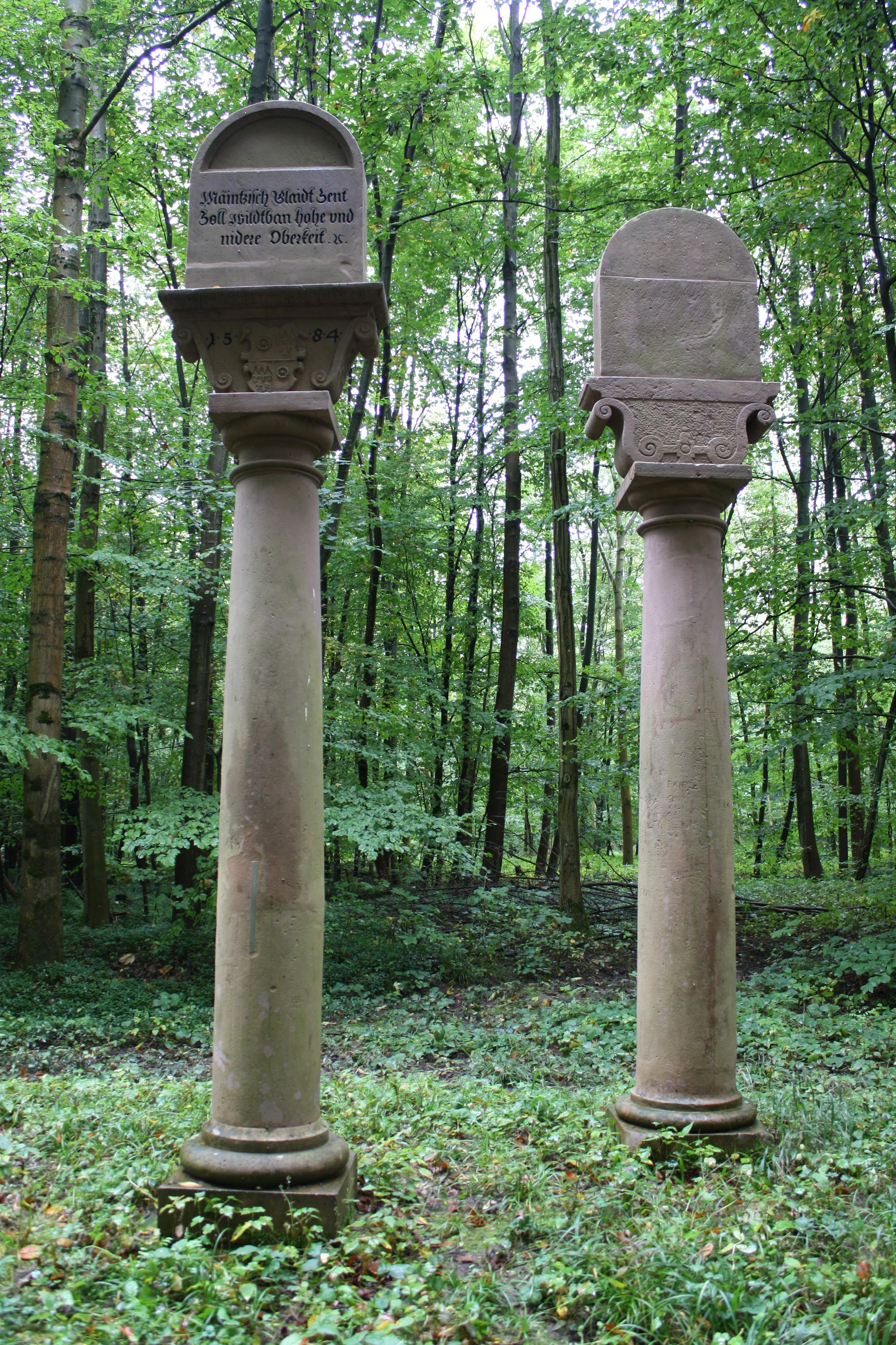
Deutsch: Die Hoheitssäulen, an einer alten Straße gelegen, markierten die Grenze zwischen den Fürstbistümern Mainz und Würzburg, heute zwischen Baden-Württemberg und Bayern. |
| Date | 6 September 2021, 21:34:28 (original upload date) |
| Source | overview - direct - dataset |
| Author | Angelika Halama |
| Permission (Reusing this file) |
Creative Commons Zero (CC0) |
| ID | 495571 |
| Category | 1872 |
| Object location | | View this and other nearby images on: OpenStreetMap |
|---|
This media file was collected by Landauf, LandApp under the ID 495571. This tag does not indicate the copyright status of the attached work. A normal copyright tag is still required. See Commons:Licensing. |
Licensing edit
| This file is made available under the Creative Commons CC0 1.0 Universal Public Domain Dedication. | |
| The person who associated a work with this deed has dedicated the work to the public domain by waiving all of their rights to the work worldwide under copyright law, including all related and neighboring rights, to the extent allowed by law. You can copy, modify, distribute and perform the work, even for commercial purposes, all without asking permission.
|
File history
Click on a date/time to view the file as it appeared at that time.
| Date/Time | Thumbnail | Dimensions | User | Comment | |
|---|---|---|---|---|---|
| current | 09:59, 3 May 2023 | | 2,592 × 3,888 (1.97 MB) | LaserlichtBot (talk | contribs) | =={{int:filedesc}}== {{Information |description={{de|1=Die Hoheitssäulen, an einer alten Straße gelegen, markierten die Grenze zwischen den Fürstbistümern Mainz und Würzburg, heute zwischen Baden-Württemberg und Bayern.}} |date=2021-09-06 21:34:28 |source=[https://www.spotteron.com/landappbw/spots/495571 overview] - [https://files.spotteron.com/images/spots/000022/2021/09/06/b7kur3gl0qxxkk3ph6s4jf058m9py995.jpg direct] |author=[https://www.spotteron.com/landappbw/users/55851/spots Angelika Ha... |
You cannot overwrite this file.
File usage on Commons
There are no pages that use this file.
File usage on other wikis
The following other wikis use this file:
- Usage on de.wikipedia.org