File:Landbouwtyperingskaart, Vlaanderen, 2007.png
No higher resolution available.
Landbouwtyperingskaart,_Vlaanderen,_2007.png (526 × 395 pixels, file size: 317 KB, MIME type: image/png)
Captions
Captions
Add a one-line explanation of what this file represents
Summary edit
| Description |
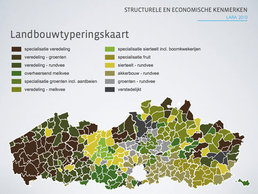
Nederlands: Deze kaart geeft het resultaat weer van een classificatie van gemeenten in Vlaanderen met een gelijkaardige landbouwactiviteit. |
| Date | |
| Source | Own work |
| Author | Dep lv ams |
| Permission (Reusing this file) |
I, the copyright holder of this work, hereby publish it under the following license: This file is licensed under the Creative Commons Attribution-Share Alike 3.0 Unported license.
|
File history
Click on a date/time to view the file as it appeared at that time.
| Date/Time | Thumbnail | Dimensions | User | Comment | |
|---|---|---|---|---|---|
| current | 07:38, 14 June 2011 | | 526 × 395 (317 KB) | Dep lv ams (talk | contribs) |
You cannot overwrite this file.
File usage on Commons
There are no pages that use this file.