File:Landforms on Mars.jpg
Original file (2,880 × 1,800 pixels, file size: 4.16 MB, MIME type: image/jpeg)
Captions
Captions
Summary edit
| Description |
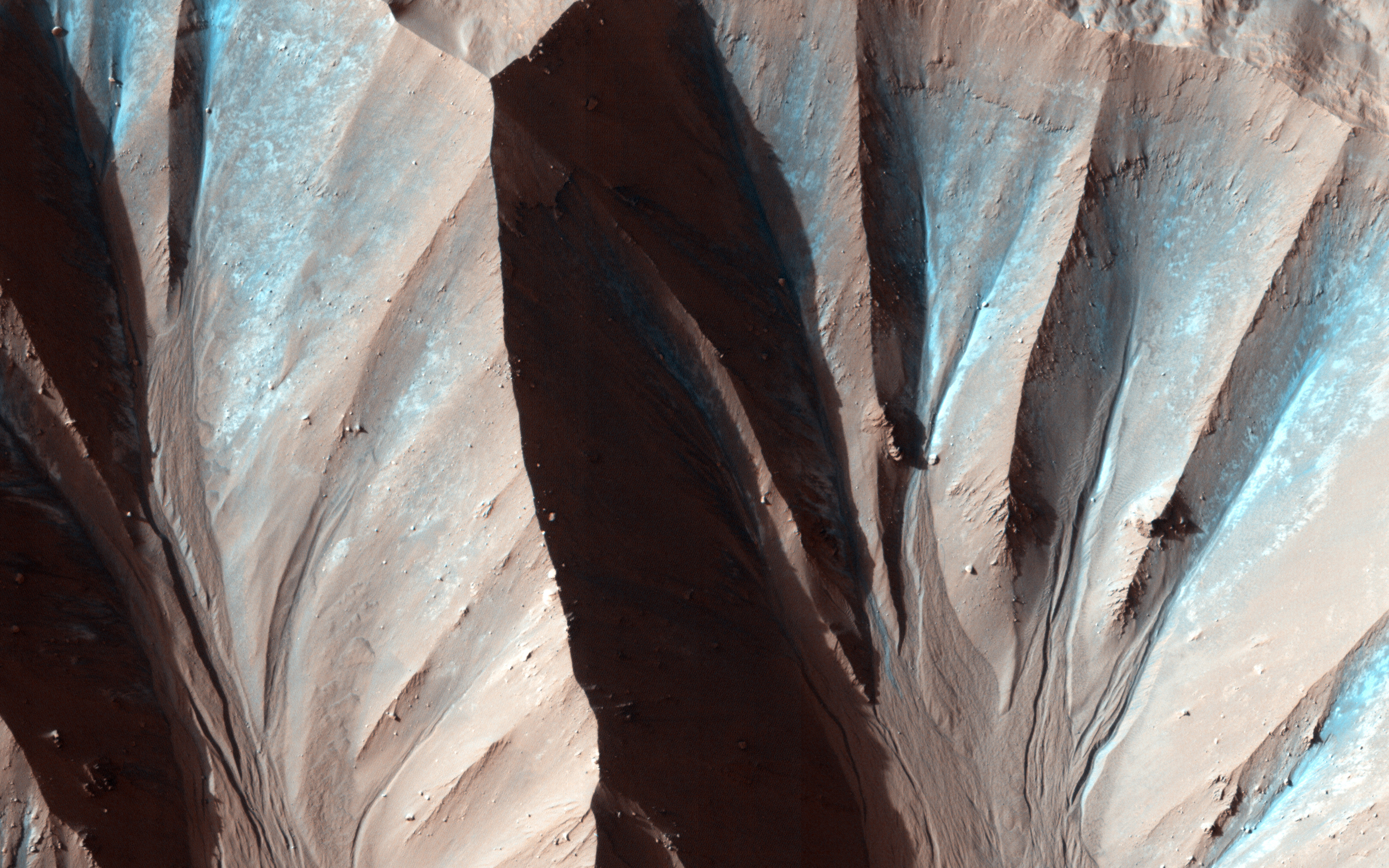
English: This image was taken by the High Resolution Imaging Science Experiment (HiRISE) flying onboard the Mars Reconnaissance Orbiter mission.
Gully landforms like those in this image are found in many craters in the mid-latitudes of Mars. Changes in gullies were first seen in images from the Mars Orbiter Camera in 2006, and studying such activity has been a high priority for HiRISE. Many examples of new deposits in gullies are now known. This image shows a new deposit in Gasa Crater, in the Southern mid-latitudes. The deposit is distinctively blue in enhanced-color images. This image was acquired in southern spring, but the flow that formed the deposit occurred in the preceding winter. Current gully activity appears to be concentrated in winter and early spring, and may be caused by the seasonal carbon dioxide frost that is visible in gully alcoves in the winter. Written by: Colin Dundas |
| Date | |
| Source | http://www.nasa.gov/multimedia/imagegallery/image_feature_2470.html |
| Author | NASA/JPL/University of Arizona |
Licensing edit
| This file is in the public domain in the United States because it was solely created by NASA. NASA copyright policy states that "NASA material is not protected by copyright unless noted". (See Template:PD-USGov, NASA copyright policy page or JPL Image Use Policy.) | ||
 |
Warnings:
|
File history
Click on a date/time to view the file as it appeared at that time.
| Date/Time | Thumbnail | Dimensions | User | Comment | |
|---|---|---|---|---|---|
| current | 13:59, 15 March 2013 | | 2,880 × 1,800 (4.16 MB) | Stas1995 (talk | contribs) | User created page with UploadWizard |
You cannot overwrite this file.
File usage on Commons
There are no pages that use this file.