File:Landset 9 image of Bangladesh coast.jpg

Size of this preview: 800 × 450 pixels. Other resolutions: 320 × 180 pixels | 640 × 360 pixels | 1,024 × 576 pixels | 1,280 × 720 pixels | 2,400 × 1,350 pixels.
Original file (2,400 × 1,350 pixels, file size: 2.92 MB, MIME type: image/jpeg)
Captions
Captions
Add a one-line explanation of what this file represents
Summary
edit
| Description |
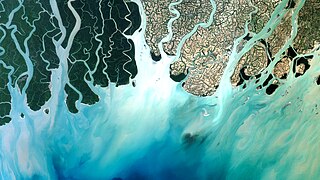
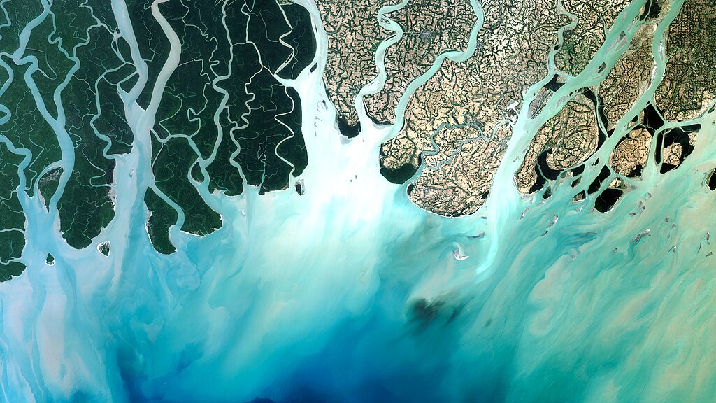
English: Landsat 9 natural color image (Bands 4, 3, 2) of the Bangladesh coastline on the Bay of Bengal acquired on February 8, 2022. The Sundarbans mangrove forest, a protected UNESCO area, appears as dark green on the left side of the image. The right side of the image shows agricultural lands and urban areas as light tan and gray. Between Landsat 8 and Landsat 9, the Landsat program delivers complete coverage of the Earth’s surface every eight days. |
| Date | |
| Source | https://www.usgs.gov/media/images/landsat-9-image-bangladesh-coast |
| Author | NASA |
Licensing
edit
| This file is in the public domain in the United States because it was solely created by NASA. NASA copyright policy states that "NASA material is not protected by copyright unless noted". (See Template:PD-USGov, NASA copyright policy page or JPL Image Use Policy.) | ||
 |
Warnings:
|
File history
Click on a date/time to view the file as it appeared at that time.
| Date/Time | Thumbnail | Dimensions | User | Comment | |
|---|---|---|---|---|---|
| current | 21:51, 25 October 2022 | | 2,400 × 1,350 (2.92 MB) | Meghmollar2017 (talk | contribs) | Uploaded a work by NASA from https://www.usgs.gov/media/images/landsat-9-image-bangladesh-coast with UploadWizard |
You cannot overwrite this file.
File usage on Commons
The following page uses this file: