File:Las Machorras - La Peña Lusa (6582227083).jpg
Size of this preview: 800 × 600 pixels. Other resolutions: 320 × 240 pixels | 640 × 480 pixels | 1,024 × 768 pixels | 1,280 × 960 pixels | 2,560 × 1,920 pixels | 3,648 × 2,736 pixels.
Original file (3,648 × 2,736 pixels, file size: 2.11 MB, MIME type: image/jpeg)
Captions
Captions
Add a one-line explanation of what this file represents
Summary edit
.jpg&action=edit§ion=1)
| Description |
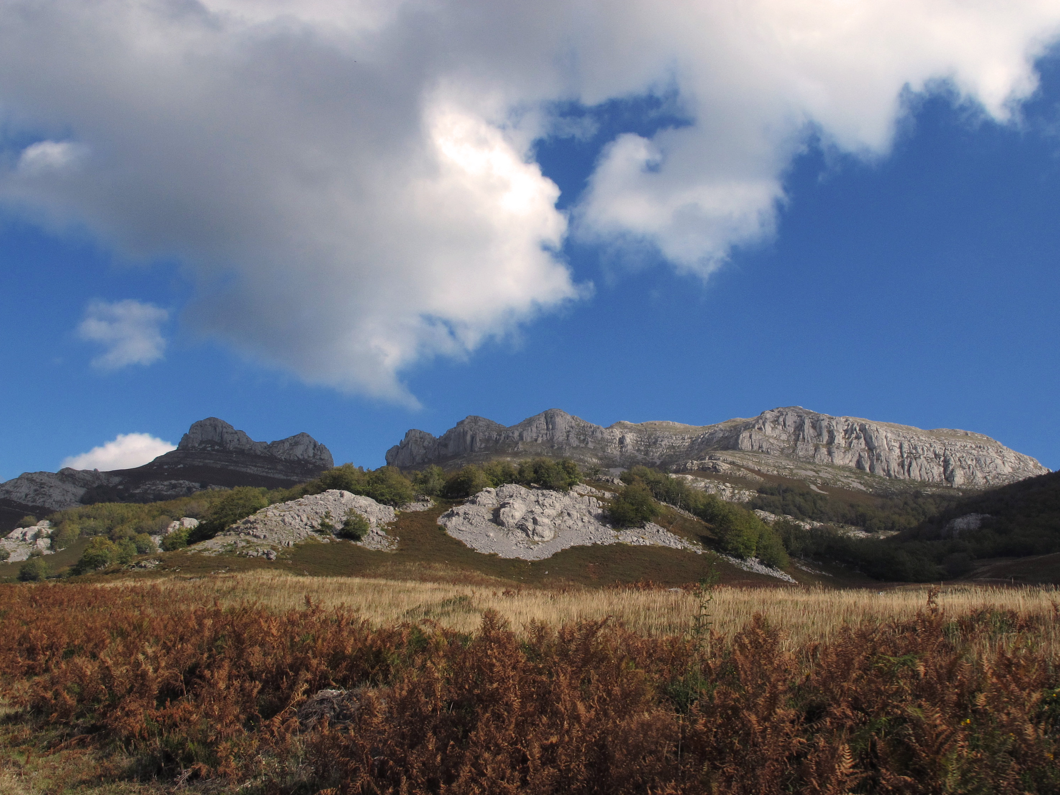
Español: Al norte de burgos, separa el glaciar circo de Lunada (Burgos) y el profundo valle de Asón (Cantabria). El agua, ha encontrado en la piedra caliza de la que está formado, un inmejorable lienzo sobre el que dibujar todos los procesos kársticos
bu-572 |
| Date | |
| Source | https://www.flickr.com/photos/70626035@N00/6582227083/ |
| Author | jacilluch |
| Flickr sets |
|
| Flickr pools |
|
| Flickr tags |
|
| Flickr posted date | 27 December 2011 |
| Camera location | | View this and other nearby images on: OpenStreetMap |
|---|
.jpg¶ms=043.173031_N_-003.623771_E_globe:Earth_type:camera__&language=en)
Licensing edit
.jpg&action=edit§ion=2)
This file is licensed under the Creative Commons Attribution-Share Alike 2.0 Generic license.
- You are free:
- to share – to copy, distribute and transmit the work
- to remix – to adapt the work
- Under the following conditions:
- attribution – You must give appropriate credit, provide a link to the license, and indicate if changes were made. You may do so in any reasonable manner, but not in any way that suggests the licensor endorses you or your use.
- share alike – If you remix, transform, or build upon the material, you must distribute your contributions under the same or compatible license as the original.
| This image was originally posted to Flickr by jacilluch at https://flickr.com/photos/70626035@N00/6582227083 (archive). It was reviewed on 27 December 2018 by FlickreviewR 2 and was confirmed to be licensed under the terms of the cc-by-sa-2.0. |
File history
Click on a date/time to view the file as it appeared at that time.
| Date/Time | Thumbnail | Dimensions | User | Comment | |
|---|---|---|---|---|---|
| current | 23:50, 27 December 2018 | | 3,648 × 2,736 (2.11 MB) | Discasto (talk | contribs) | == {{int:filedesc}} == {{information |description={{es|1=Al norte de burgos, separa el glaciar circo de Lunada (Burgos) y el profundo valle de Asón (Cantabria). El agua, ha encontrado en la piedra caliza de la que está formado, un inmejorable lienzo sobre el que dibujar todos los procesos kársticos bu-572}} |date=2011-10-23 13:22:35 |author=[https://www.flickr.com/people/70626035@N00 jacilluch] |source=https://www.flickr.com/photos/70626035@N00/6582227083/ |permission= |other_versions= |oth... |
You cannot overwrite this file.
File usage on Commons
There are no pages that use this file.
File usage on other wikis
The following other wikis use this file:
- Usage on es.wikipedia.org
.jpg&oldid=552080512)