File:Latrans-Turkey location Balıkesir.svg

Size of this PNG preview of this SVG file: 800 × 356 pixels. Other resolutions: 320 × 142 pixels | 640 × 285 pixels | 1,024 × 455 pixels | 1,280 × 569 pixels | 2,560 × 1,138 pixels | 1,473 × 655 pixels.
Original file (SVG file, nominally 1,473 × 655 pixels, file size: 10.88 MB)
Captions
Captions
Add a one-line explanation of what this file represents
Summary edit
| Description |
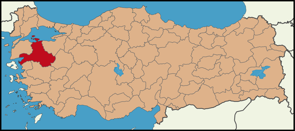
English: Location map for Balıkesir.
Türkçe: Balıkesir'in konumunu gösteren harita. |
| Date | |
| Source | Own work |
| Author | The Emirr |
Licensing edit
I, the copyright holder of this work, hereby publish it under the following licenses:

|
Permission is granted to copy, distribute and/or modify this document under the terms of the GNU Free Documentation License, Version 1.2 or any later version published by the Free Software Foundation; with no Invariant Sections, no Front-Cover Texts, and no Back-Cover Texts. A copy of the license is included in the section entitled GNU Free Documentation License. |
| This file is licensed under the Creative Commons Attribution-Share Alike 3.0 Unported license. | ||
| ||
| This licensing tag was added to this file as part of the GFDL licensing update. |
This file is licensed under the Creative Commons Attribution 3.0 Unported license.
- You are free:
- to share – to copy, distribute and transmit the work
- to remix – to adapt the work
- Under the following conditions:
- attribution – You must give appropriate credit, provide a link to the license, and indicate if changes were made. You may do so in any reasonable manner, but not in any way that suggests the licensor endorses you or your use.
You may select the license of your choice.
File history
Click on a date/time to view the file as it appeared at that time.
| Date/Time | Thumbnail | Dimensions | User | Comment | |
|---|---|---|---|---|---|
| current | 16:47, 25 June 2009 | | 1,473 × 655 (10.88 MB) | The Emirr (talk | contribs) | {{Information |Description={{en|1=Location map for Balıkesir.}} {{tr|1=Balıkesir'in konumunu gösteren harita.}} |Source=Own work by uploader |Author=The Emirr |Date=25.06.2009 |Permission={{The Emirr}} |other_versions=There is not an |
You cannot overwrite this file.
File usage on Commons
The following page uses this file:
File usage on other wikis
The following other wikis use this file:
- Usage on ar.wikipedia.org
- Usage on ast.wikipedia.org
- Usage on cy.wikipedia.org
- Usage on en.wikipedia.org
- Savaştepe
- Template:Savaştepe District
- Akpınar, Savaştepe
- Ardıçlı, Savaştepe
- Aşağıdanişment, Savaştepe
- Beyköy, Savaştepe
- Bozalan, Savaştepe
- Çaltılı, Savaştepe
- Çamurlu, Savaştepe
- Çavlı, Savaştepe
- Çiftlikdere, Savaştepe
- Çukurçayır, Savaştepe
- Deveören, Savaştepe
- Dikmeler, Savaştepe
- Eyerci, Savaştepe
- Esenköy, Savaştepe
- Güvem, Savaştepe
- Güvemküçüktarla, Savaştepe
- Hıdırbalı, Savaştepe
- İsadere, Savaştepe
- Kalemköy, Savaştepe
- Karacalar, Savaştepe
- Karaçam, Savaştepe
- Karapınar, Savaştepe
- Kocabıyıklar, Savaştepe
- Kongurca, Savaştepe
- Kurudere, Savaştepe
- Madenmezarı, Savaştepe
- Mecidiye, Savaştepe
- Minnetler, Savaştepe
- Pelitcik, Savaştepe
- Sarısüleymanlar, Savaştepe
- Sıtmapınar, Savaştepe
- Soğucak, Savaştepe
- Söğütçük, Savaştepe
- Söğütlügözle, Savaştepe
- Tavşancık, Savaştepe
- Türediler, Savaştepe
- Yazören, Savaştepe
- Yolcupınarı, Savaştepe
- Yukarıdanişment, Savaştepe
- Yukarıkaraçam, Savaştepe
- Yunakdere, Savaştepe
- Usage on es.wikipedia.org
- Usage on fr.wikipedia.org
View more global usage of this file.