File:Le Coq 15 (XV) Karte des Rheins von Wesel bis Duisburg sowie der Gegend an beiden Ufern der Lippe von Lünen bis Wesel und der Ruhr von Wetter bis Duisburg. (3491).jpg

Size of this preview: 800 × 524 pixels. Other resolutions: 320 × 210 pixels | 640 × 419 pixels | 1,024 × 671 pixels | 1,280 × 838 pixels | 2,560 × 1,676 pixels | 8,309 × 5,441 pixels.
Original file (8,309 × 5,441 pixels, file size: 7.2 MB, MIME type: image/jpeg)
Captions
Captions
Add a one-line explanation of what this file represents
Summary
edit_Karte_des_Rheins_von_Wesel_bis_Duisburg_sowie_der_Gegend_an_beiden_Ufern_der_Lippe_von_L%C3%BCnen_bis_Wesel_und_der_Ruhr_von_Wetter_bis_Duisburg._(3491).jpg&action=edit§ion=1)
| Description |
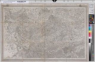
English: Title: "Karte des Rheins von Wesel bis Duisburg sowie der Gegend an beiden Ufern der Lippe von Lünen bis Wesel und der Ruhr von Wetter bis Duisburg. Sect. XV. Hrsg. von dem Generalmojor v. Le Coq 1805. Gemessen vom Capitain v. Engelbracht, den Leutenants v. Herwarth, v. Luck, v. Voss, V. Hake, Kellner, v. Reiche, v. Bornstaedt. Gestochen von Carl Jättnig d.Ä. Berlin 1812" [Doppelstück zu 3213] |
| Date | |
| Source | Landesarchiv NRW Abteilung Rheinland / RW Karten, 1.1.1. Karte von Nordwestdeutschland von v. Le Coq (1797-1813).-Reproduktion (1957) |
| Author | Karl Ludwig von Le Coq |
Licensing
edit_Karte_des_Rheins_von_Wesel_bis_Duisburg_sowie_der_Gegend_an_beiden_Ufern_der_Lippe_von_L%C3%BCnen_bis_Wesel_und_der_Ruhr_von_Wetter_bis_Duisburg._(3491).jpg&action=edit§ion=2)
This file is licensed under the Creative Commons Attribution-Share Alike 4.0 International license.
- You are free:
- to share – to copy, distribute and transmit the work
- to remix – to adapt the work
- Under the following conditions:
- attribution – You must give appropriate credit, provide a link to the license, and indicate if changes were made. You may do so in any reasonable manner, but not in any way that suggests the licensor endorses you or your use.
- share alike – If you remix, transform, or build upon the material, you must distribute your contributions under the same or compatible license as the original.
File history
Click on a date/time to view the file as it appeared at that time.
| Date/Time | Thumbnail | Dimensions | User | Comment | |
|---|---|---|---|---|---|
| current | 15:07, 29 February 2024 | | 8,309 × 5,441 (7.2 MB) | Hilbeck (talk | contribs) | Uploaded a work by Karl Ludwig von Le Coq from Landesarchiv NRW Abteilung Rheinland / RW Karten, 1.1.1. Karte von Nordwestdeutschland von v. Le Coq (1797-1813).-Reproduktion (1957) with UploadWizard |
You cannot overwrite this file.
File usage on Commons
There are no pages that use this file.
_Karte_des_Rheins_von_Wesel_bis_Duisburg_sowie_der_Gegend_an_beiden_Ufern_der_Lippe_von_Lünen_bis_Wesel_und_der_Ruhr_von_Wetter_bis_Duisburg._(3491).jpg&oldid=859028266)