File:Le plan de la ville, cité, et université de Paris by Nicolas de Fer, 1705 - Stanford Libraries.tif

Size of this JPG preview of this TIF file: 800 × 539 pixels. Other resolutions: 320 × 216 pixels | 640 × 432 pixels | 1,024 × 690 pixels | 1,280 × 863 pixels | 2,560 × 1,726 pixels | 5,400 × 3,641 pixels.
Original file (5,400 × 3,641 pixels, file size: 18.77 MB, MIME type: image/tiff)
Captions
Captions
Add a one-line explanation of what this file represents
Summary edit
| Title |
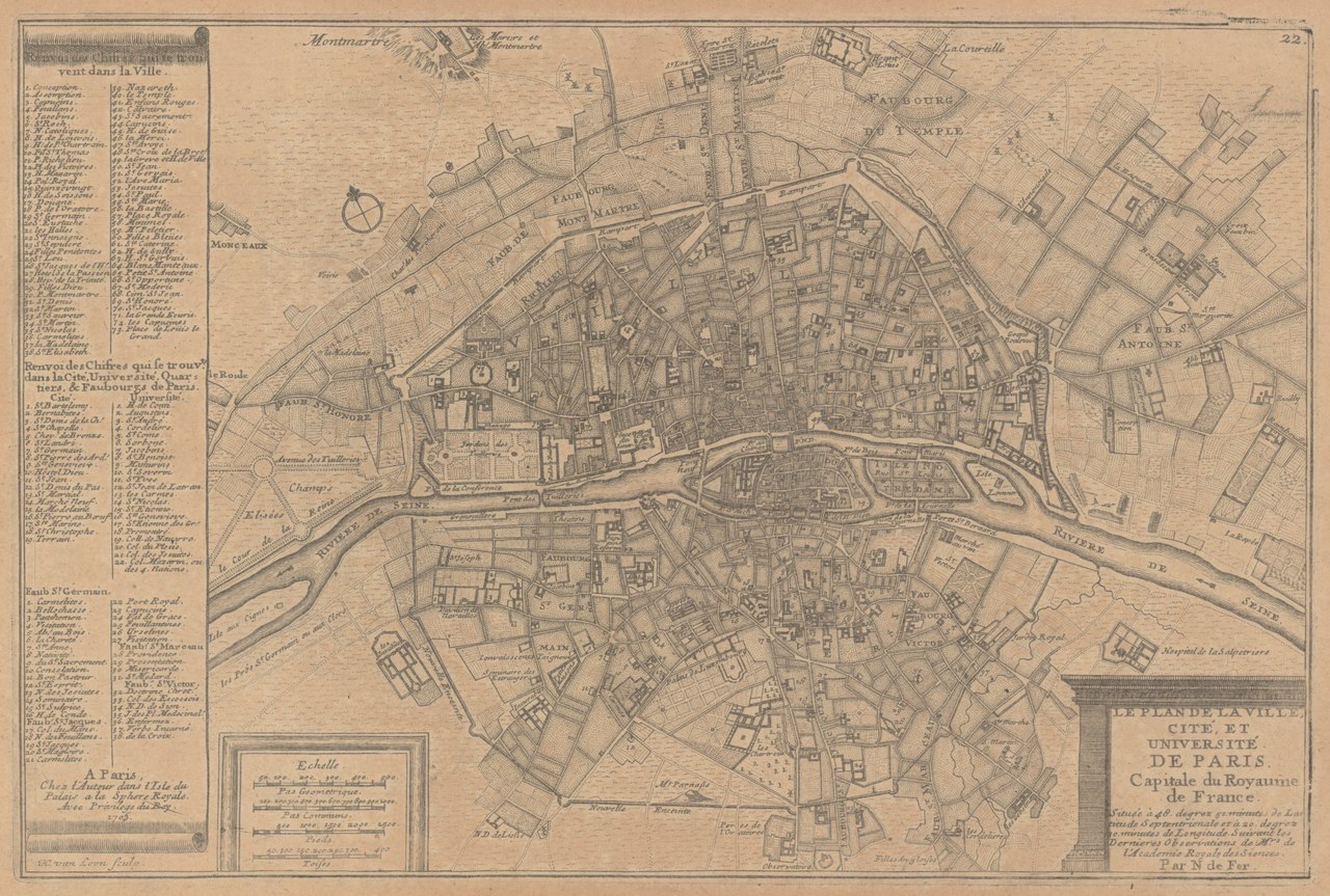
Le plan de la ville, cité, et université de Paris : capitale du Royaume de France |
| Description |
English: Relief shown pictorially. In: N. de Fer's Atlas curieux ... 1705, p. [22]. Indexed for points of interest. |
| Date | |
| Source | Stanford Libraries |
| Creator |
Nicolas de Fer |
| Georeferencing | If inappropriate please set warp_status = skip to hide. |
| Bibliographic data | |
| Publisher |
A Paris : Chez l'auteur dans l'Isle du Palais à la Sphere Royale, 1705. |
| Archival data | |
| Collection | Stanford Libraries |
| Medium | 1 map |
Licensing edit
|
This work is in the public domain in its country of origin and other countries and areas where the copyright term is the author's life plus 100 years or fewer. This work is in the public domain in the United States because it was published (or registered with the U.S. Copyright Office) before January 1, 1929. | |
| This file has been identified as being free of known restrictions under copyright law, including all related and neighboring rights. | |
File history
Click on a date/time to view the file as it appeared at that time.
| Date/Time | Thumbnail | Dimensions | User | Comment | |
|---|---|---|---|---|---|
| current | 15:11, 8 July 2020 |  | 5,400 × 3,641 (18.77 MB) | Paris 16 (talk | contribs) | Uploaded own work with UploadWizard |
You cannot overwrite this file.
File usage on Commons
There are no pages that use this file.