File:Lee County Alabama Incorporated and Unincorporated areas Opelika Highlighted2008.svg

Size of this PNG preview of this SVG file: 750 × 350 pixels. Other resolutions: 320 × 149 pixels | 640 × 299 pixels | 1,024 × 478 pixels | 1,280 × 597 pixels | 2,560 × 1,195 pixels.
Original file (SVG file, nominally 750 × 350 pixels, file size: 141 KB)
Captions
Captions
Add a one-line explanation of what this file represents
Summary edit
| Description |
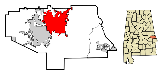
English: This map shows the incorporated and unincorporated areas in en:Lee County, Alabama, highlighting Opelika in red. It was created in Inkscape. |
| Date |
27 January 2008 (original upload date) |
| Source | My own work, based on similar map concepts by Ixnayonthetimmay. |
| Author | (Original text: Lissoy) |
Licensing edit
Lissoy at the English-language Wikipedia, the copyright holder of this work, hereby publishes it under the following license:

|
Permission is granted to copy, distribute and/or modify this document under the terms of the GNU Free Documentation License, Version 1.2 or any later version published by the Free Software Foundation; with no Invariant Sections, no Front-Cover Texts, and no Back-Cover Texts. A copy of the license is included in the section entitled GNU Free Documentation License. |
| This file is licensed under the Creative Commons Attribution-Share Alike 3.0 Unported license. | ||
| Attribution: Lissoy | ||
| ||
| This licensing tag was added to this file as part of the GFDL licensing update. |
Original upload log edit
The original description page was here. All following user names refer to en.wikipedia.
- 2008-01-27 18:27 Lissoy 750×350×0 (144579 bytes) {{Information |Description=This map shows the incorporated and unincorporated areas in [[Lee County, Alabama]], highlighting [[Opelika, Alabama|Opelika]] in red. It was created in Inkscape. |Source=My own work, based on similar map concepts by [[User:Ixna
File history
Click on a date/time to view the file as it appeared at that time.
| Date/Time | Thumbnail | Dimensions | User | Comment | |
|---|---|---|---|---|---|
| current | 00:34, 11 February 2008 | | 750 × 350 (141 KB) | File Upload Bot (Magnus Manske) (talk | contribs) | {{BotMoveToCommons|en.wikipedia}} {{Information |Description={{en|This map shows the incorporated and unincorporated areas in en:Lee County, Alabama, highlighting Opelika in red. It was created in Inkscape.}} |Source=Transfe |
You cannot overwrite this file.
File usage on Commons
The following 2 pages use this file:
File usage on other wikis
The following other wikis use this file:
- Usage on ar.wikipedia.org
- Usage on arz.wikipedia.org
- Usage on azb.wikipedia.org
- Usage on ca.wikipedia.org
- Usage on ceb.wikipedia.org
- Usage on cy.wikipedia.org
- Usage on de.wikipedia.org
- Usage on es.wikipedia.org
- Usage on eu.wikipedia.org
- Usage on fa.wikipedia.org
- Usage on fr.wikipedia.org
- Usage on ht.wikipedia.org
- Usage on hu.wikipedia.org
- Usage on it.wikipedia.org
- Usage on no.wikipedia.org
- Usage on sr.wikipedia.org
- Usage on tt.wikipedia.org
- Usage on vo.wikipedia.org
- Usage on www.wikidata.org
- Usage on zh-min-nan.wikipedia.org