File:Liberia Stammesgebiete.jpg

Size of this preview: 571 × 600 pixels. Other resolutions: 229 × 240 pixels | 457 × 480 pixels | 818 × 859 pixels.
Original file (818 × 859 pixels, file size: 257 KB, MIME type: image/jpeg)
Captions
Captions
Add a one-line explanation of what this file represents
Summary edit
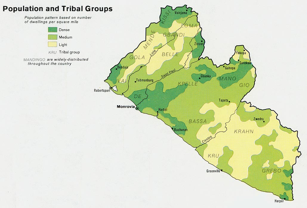
| Description |
English: Map of the Tribes in Liberia.
Deutsch: Karte der Stammesgebiete in Liberia. |
|||
| Date | ||||
| Source | Own work based on: Liberia clans.png and http://www.lib.utexas.edu/maps/africa/liberia_pop_1973.jpg | |||
| Author | Metilsteiner | |||
| Other versions |
|


Licensing edit
I, the copyright holder of this work, hereby publish it under the following license:
This file is licensed under the Creative Commons Attribution 3.0 Unported license.
- You are free:
- to share – to copy, distribute and transmit the work
- to remix – to adapt the work
- Under the following conditions:
- attribution – You must give appropriate credit, provide a link to the license, and indicate if changes were made. You may do so in any reasonable manner, but not in any way that suggests the licensor endorses you or your use.
File history
Click on a date/time to view the file as it appeared at that time.
| Date/Time | Thumbnail | Dimensions | User | Comment | |
|---|---|---|---|---|---|
| current | 18:39, 16 October 2010 | | 818 × 859 (257 KB) | Metilsteiner (talk | contribs) | {{Information |Description={{en|1=Map of the Tribes in Liberia.}} {{de|1=Karte der Stammesgebiete in Liberia.}} |Source={{own}} |Author=Metilsteiner |Date=2010-10-16 |Permission= |other_versions= }} Die Grafik basiert auf den Vorlage |
You cannot overwrite this file.
File usage on Commons
The following page uses this file:
File usage on other wikis
The following other wikis use this file:
- Usage on als.wikipedia.org
- Usage on de.wikipedia.org
- Usage on eo.wikipedia.org