File:Lindenhof - Hedwigbrunnen - McL 2012-09-26 16-46-11.JPG
Size of this preview: 400 × 600 pixels. Other resolutions: 160 × 240 pixels | 320 × 480 pixels | 512 × 768 pixels | 682 × 1,024 pixels | 1,365 × 2,048 pixels | 3,200 × 4,800 pixels.
Original file (3,200 × 4,800 pixels, file size: 6.06 MB, MIME type: image/jpeg)
Captions
Captions
Add a one-line explanation of what this file represents
Summary edit
| Description |
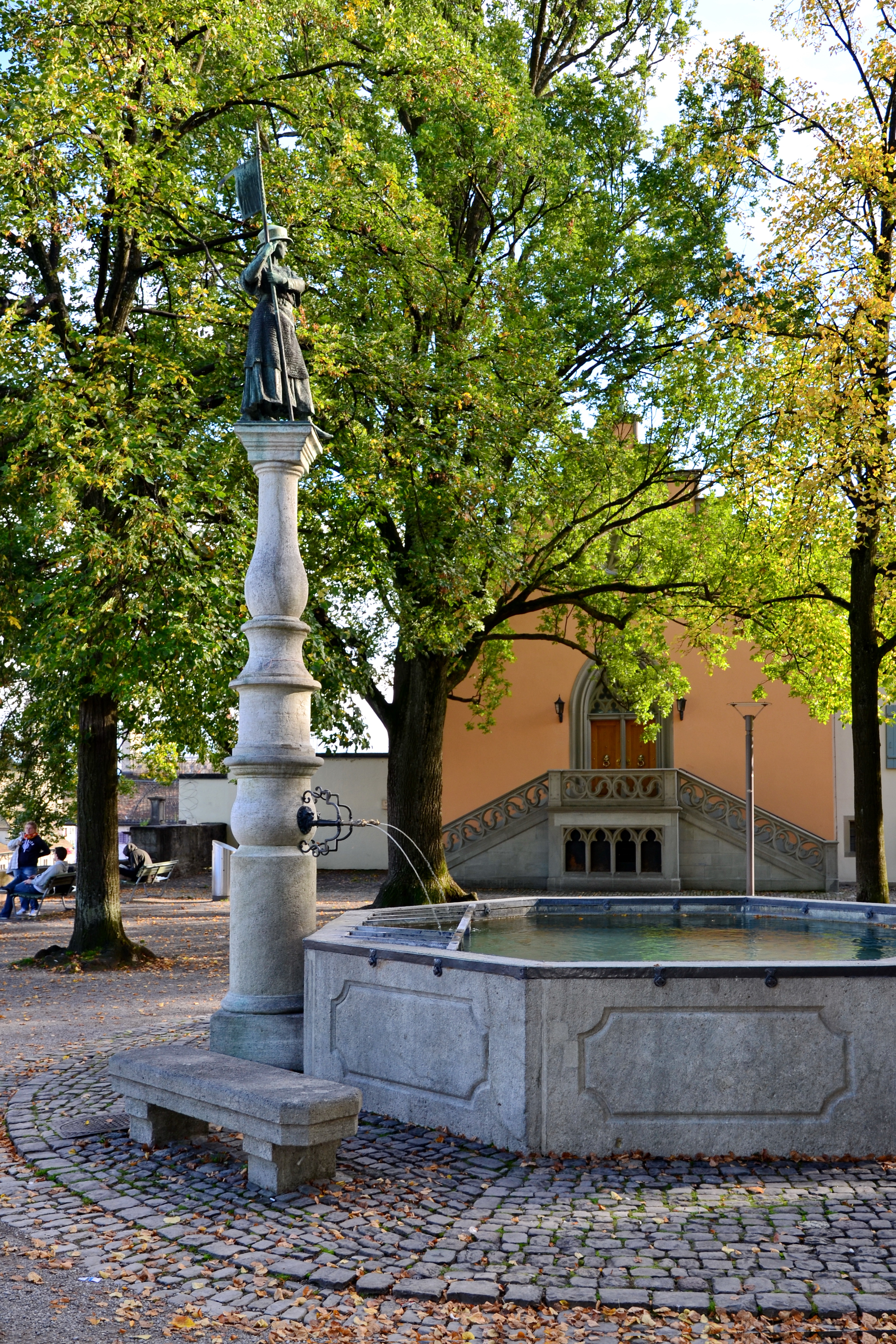
Deutsch: Lindenhof in Zürich, im Hintergrund das Logenhaus 'McL'. Der erste Brunnen ist 1666 bis 1668 von Generalfeldzeugmeister Hans Georg Werdmüller errichtet worden, gekrönt von einer repräsentativen Löwenfigur mit Wappenschild. Der Brunnen wechselte mehrmals den Standort, und sein Becken wurde 1730 (der Stein stammt aus Walenstadt und Würenlos) vergrössert und mit zwei Röhren versehen. Nach verschiedenen Umgestaltungen wurde der heutige Brunnen 1912 erbaut. Die Brunnenfigur (im Volksmund Hedwig genannt) ist eine geharnischte Frauengestalt, geschaffen von Gustav Siber. Sie erinnert an die Legende der tapferen Zürcherinnen, die 1292 in Kampfmontur das Heer von Herzog Albrecht I. von Habsburg abschreckten, indem sie sich auf dem Lindenhof versammelten und so ein kampfkräftiges Heer vortäuschten - die Zürcher Männer sollen zu diesem Zeitpunkt auf einem Kriegszug gegen Winterthur gewesen sein und die Stadt unverteidigt zurückgelassen haben.
|
||
| Date | Taken on 26 September 2012 | ||
| Source | Own work | ||
| Author | roland zh | ||
| Other versions |
|
||
| Attribution (required by the license) | © Roland Fischer, Zürich (Switzerland) – Mail notification to: roland_zh(at)hispeed(dot)ch / Wikimedia Commons / | ||


Licensing edit
I, the copyright holder of this work, hereby publish it under the following license:
This file is licensed under the Creative Commons Attribution-Share Alike 3.0 Unported license.
- You are free:
- to share – to copy, distribute and transmit the work
- to remix – to adapt the work
- Under the following conditions:
- attribution – You must give appropriate credit, provide a link to the license, and indicate if changes were made. You may do so in any reasonable manner, but not in any way that suggests the licensor endorses you or your use.
- share alike – If you remix, transform, or build upon the material, you must distribute your contributions under the same or compatible license as the original.

|
This image was uploaded as part of Wiki Loves Monuments 2012.
|
}}
| Camera location | | View this and other nearby images on: OpenStreetMap |
|---|
File history
Click on a date/time to view the file as it appeared at that time.
| Date/Time | Thumbnail | Dimensions | User | Comment | |
|---|---|---|---|---|---|
| current | 22:27, 27 September 2012 | | 3,200 × 4,800 (6.06 MB) | Roland zh (talk | contribs) | =={{int:filedesc}}== {{Information {{Information |Description={{de|Lindenhof in Zürich, im Hintergrund das Logenhaus 'McL'. Der erste Brunnen ist 1666 bis 1668 von Generalfeldzeugmeister ... |
You cannot overwrite this file.
File usage on Commons
There are no pages that use this file.