File:Llandanwg Pensarn Harbour and Shell Island.jpg
Size of this preview: 800 × 413 pixels. Other resolutions: 320 × 165 pixels | 640 × 330 pixels | 1,024 × 528 pixels | 1,280 × 660 pixels | 2,560 × 1,321 pixels | 6,000 × 3,096 pixels.
Original file (6,000 × 3,096 pixels, file size: 12.13 MB, MIME type: image/jpeg)
File information
Structured data
Captions
DescriptionLlandanwg Pensarn Harbour and Shell Island.jpg |
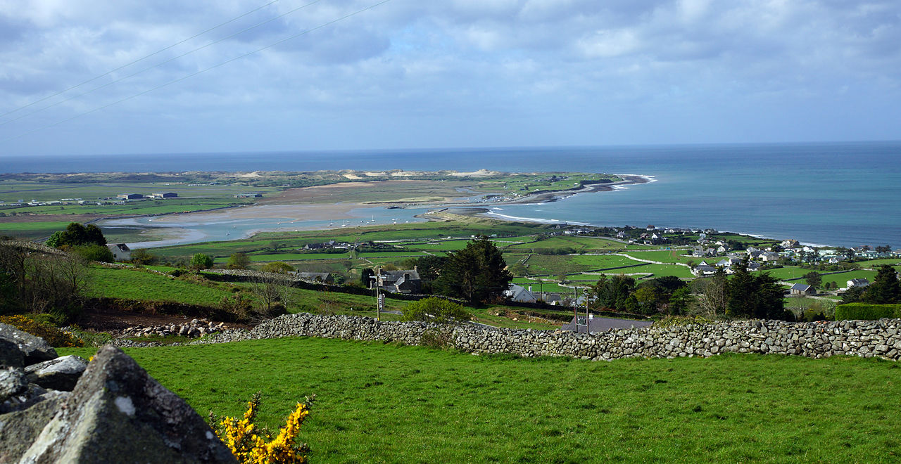
English: Llandanwg (right), Pensarn Harbour and Shell Island (above), in Gwynedd, Wales. Llanbedr Airport is on the left. |
Date | Taken on 26 April 2014 |
Source | Own work |
Author | Oosoom at English Wikipedia |
Permission (Reusing this file) |
I, the copyright holder of this work, hereby publish it under the following license: This file is licensed under the Creative Commons Attribution-Share Alike 3.0 Unported license.
|
Camera location | 52° 50′ 45.24″ N, 4° 06′ 37.03″ W | View this and other nearby images on: OpenStreetMap | 52.845901; -4.110286 |
---|
File history
Click on a date/time to view the file as it appeared at that time.
Date/Time | Thumbnail | Dimensions | User | Comment | |
---|---|---|---|---|---|
current | 15:29, 28 April 2014 | 6,000 × 3,096 (12.13 MB) | Oosoom (talk | contribs) | {{Information |Description={{en|Llandanwg (below sea) and Shell Island (above sea), Gwynedd, Wales. LKlandanwg church is in the sand dunes at the left of the picture.}} |Source={{Own}} |Date=={{taken on|{{ISOdate|2014... |
You cannot overwrite this file.
File usage on Commons
The following page uses this file:
File usage on other wikis
The following other wikis use this file:
- Usage on ceb.wikipedia.org
- Usage on cy.wikipedia.org
- Usage on de.wikipedia.org
- Usage on en.wikipedia.org
- Usage on www.wikidata.org
Metadata
This file contains additional information such as Exif metadata which may have been added by the digital camera, scanner, or software program used to create or digitize it. If the file has been modified from its original state, some details such as the timestamp may not fully reflect those of the original file. The timestamp is only as accurate as the clock in the camera, and it may be completely wrong.
Camera manufacturer | SONY |
---|---|
Camera model | SLT-A77V |
Exposure time | 1/200 sec (0.005) |
F-number | f/13 |
ISO speed rating | 100 |
Date and time of data generation | 08:46, 26 April 2014 |
Lens focal length | 35 mm |
Latitude | 52° 50′ 45.46″ N |
Longitude | 4° 6′ 33.4″ W |
Altitude | 130.57 meters above sea level |
Orientation | Normal |
Horizontal resolution | 350 dpi |
Vertical resolution | 350 dpi |
Software used | Adobe Photoshop CS4 Windows |
File change date and time | 16:10, 28 April 2014 |
Y and C positioning | Co-sited |
Exposure Program | Normal program |
Exif version | 2.3 |
Date and time of digitizing | 08:46, 26 April 2014 |
Meaning of each component |
|
Image compression mode | 2 |
APEX brightness | 10.09921875 |
APEX exposure bias | 0 |
Maximum land aperture | 2.96875 APEX (f/2.8) |
Metering mode | Pattern |
Light source | Unknown |
Flash | Flash did not fire, auto mode |
Supported Flashpix version | 1 |
Color space | sRGB |
File source | Digital still camera |
Scene type | A directly photographed image |
Custom image processing | Normal process |
Exposure mode | Auto exposure |
White balance | Auto white balance |
Focal length in 35 mm film | 52 mm |
Scene capture type | Standard |
Contrast | Normal |
Saturation | Normal |
Sharpness | Normal |
GPS time (atomic clock) | 08:46 |
Receiver status | Measurement in progress |
Measurement mode | 3-dimensional measurement |
Measurement precision | Poor (1.224) |
Speed unit | Kilometers per hour |
Speed of GPS receiver | 0.353 |
Reference for direction of movement | True direction |
Direction of movement | 286.24 |
Geodetic survey data used | WGS-84 |
GPS date | 26 April 2014 |
GPS differential correction | 0 |
GPS tag version | 0.0.3.2 |
Supported Flashpix version | 1 |
Image width | 6,000 px |
Image height | 3,096 px |
Date metadata was last modified | 17:10, 28 April 2014 |
Unique ID of original document | xmp.did:170B3331E7CEE311BA6097C208033921 |