File:Locatie Bellingwolde.png
No higher resolution available.
Locatie_Bellingwolde.png (280 × 130 pixels, file size: 8 KB, MIME type: image/png)
Captions
Captions
Add a one-line explanation of what this file represents
Summary edit
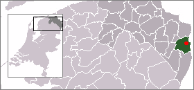
De locatie van Bellingwolde binnen de gemeente Bellingwedde. Kaart gemaakt door Marco Roepers op basis van afbeelding vervaardigd door Mtcv. Vrij voor gebruik.
Licensing edit

|
The copyright holder of this work allows anyone to use it for any purpose including unrestricted redistribution, commercial use, and modification.
Usage notes:
|
File history
Click on a date/time to view the file as it appeared at that time.
| Date/Time | Thumbnail | Dimensions | User | Comment | |
|---|---|---|---|---|---|
| current | 22:13, 7 September 2005 | | 280 × 130 (8 KB) | Roepers (talk | contribs) | De locatie van [[Bellingwolde binnen de gemeente Bellingwedde. Kaart gemaakt door ~~~ op basis van afbeelding vervaardigd door User:Mtcv. Vrij voor gebruik. {{PD}} |
You cannot overwrite this file.
File usage on Commons
The following 3 pages use this file:
File usage on other wikis
The following other wikis use this file:
- Usage on arz.wikipedia.org
- Usage on de.wikipedia.org
- Usage on fr.wikipedia.org
- Usage on fy.wikipedia.org
- Usage on it.wikipedia.org
- Usage on www.wikidata.org