File:LocationMacedonia.png
No higher resolution available.
LocationMacedonia.png (250 × 115 pixels, file size: 6 KB, MIME type: image/png)
Captions
Captions
Add a one-line explanation of what this file represents
Summary edit
| Description |
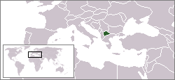
English: Location map of the Republic of Macedonia.
Deutsch: Karte zur Lage der Republik Mazedonien. |
| Date | |
| Source | Originally created for English Wikipedia by Vardion. |
| Author | Vardion |

|
File:Location Republic Of Macedonia.svg is a vector version of this file. It should be used in place of this PNG file when not inferior.
File:LocationMacedonia.png → File:Location Republic Of Macedonia.svg
For more information, see Help:SVG. |
 |
Licensing edit
| |
This work has been released into the public domain by its author, Vardion, at the English Wikipedia project. This applies worldwide. In case this is not legally possible: |
File history
Click on a date/time to view the file as it appeared at that time.
| Date/Time | Thumbnail | Dimensions | User | Comment | |
|---|---|---|---|---|---|
| current | 16:54, 6 June 2006 | | 250 × 115 (6 KB) | Rain74 (talk | contribs) | Montenegro |
| 13:28, 8 December 2004 |  | 250 × 115 (7 KB) | EugeneZelenko (talk | contribs) | Location map for the Macedonia.<br/>Originally created for English Wikipedia by Vardion.<br/>{{PD}} |
You cannot overwrite this file.
File usage on Commons
The following 2 pages use this file:
File usage on other wikis
The following other wikis use this file:
- Usage on als.wikipedia.org
- Usage on ar.wikinews.org
- Usage on av.wikipedia.org
- Usage on bg.wiktionary.org
- Usage on bpy.wikipedia.org
- Usage on bs.wikipedia.org
- Usage on bs.wikiquote.org
- Usage on ca.wikipedia.org
- Usage on ceb.wikipedia.org
- Usage on cy.wikipedia.org
- Usage on de.wikipedia.org
- Usage on de.wikinews.org
- Usage on de.wikivoyage.org
- Usage on de.wiktionary.org
- Usage on dsb.wikipedia.org
- Usage on el.wikivoyage.org
- Usage on el.wiktionary.org
- Usage on en.wikipedia.org
- Usage on en.wikinews.org
- Hari Kostov resigns as prime minister of Macedonia
- Wikinews:Template messages/Infoboxes/Countries
- Macedonia declares state of emergency due to heat wave
- Template:Republic of Macedonia
- Macedonian policeman killed in attack near Kosovo
- Macedonian police kill four militants in mountain operation
- Albanian group claims responsibility for Macedonia clashes
- At least 15 die after boat sinks in Macedonian lake
- Macedonia says compromise with Greece over name dispute possible
- North Macedonia parliament votes for deal with Bulgaria, clearing way for EU membership talks
- Usage on en.wikivoyage.org
- Usage on en.wiktionary.org
- Usage on es.wikipedia.org
- Usage on es.wikinews.org
- Usage on es.wiktionary.org
- Usage on eu.wiktionary.org
- Usage on fiu-vro.wikipedia.org
- Usage on gu.wikipedia.org
- Usage on he.wikivoyage.org
- Usage on hu.wikipedia.org
- Usage on hu.wikinews.org
- Usage on incubator.wikimedia.org
View more global usage of this file.