File:Location Map Bolivia 1848.svg

Size of this PNG preview of this SVG file: 375 × 355 pixels. Other resolutions: 254 × 240 pixels | 507 × 480 pixels | 811 × 768 pixels | 1,082 × 1,024 pixels | 2,163 × 2,048 pixels.
Original file (SVG file, nominally 375 × 355 pixels, file size: 49 KB)
Captions
Captions
Add a one-line explanation of what this file represents
Summary edit
| Description |
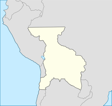
English: Location map of Bolivia in 1848 |
| Date | |
| Source | Used Inkscape |
| Author | Michael Jester |
| This file is made available under the Creative Commons CC0 1.0 Universal Public Domain Dedication. | |
| The person who associated a work with this deed has dedicated the work to the public domain by waiving all of their rights to the work worldwide under copyright law, including all related and neighboring rights, to the extent allowed by law. You can copy, modify, distribute and perform the work, even for commercial purposes, all without asking permission.
|
Licensing edit
This file is licensed under the Creative Commons Attribution-Share Alike 4.0 International license.
- You are free:
- to share – to copy, distribute and transmit the work
- to remix – to adapt the work
- Under the following conditions:
- attribution – You must give appropriate credit, provide a link to the license, and indicate if changes were made. You may do so in any reasonable manner, but not in any way that suggests the licensor endorses you or your use.
- share alike – If you remix, transform, or build upon the material, you must distribute your contributions under the same or compatible license as the original.
File history
Click on a date/time to view the file as it appeared at that time.
| Date/Time | Thumbnail | Dimensions | User | Comment | |
|---|---|---|---|---|---|
| current | 00:48, 12 October 2014 | | 375 × 355 (49 KB) | Michael Jester (talk | contribs) | {{subst:Upload marker added by en.wp UW}} {{Information |Description = {{en|Location map of Bolivia in 1848}} |Source = Used Inkscape |Date = 2014-10-11 |Author = Michael Jester }} {{cc-zero}} |
You cannot overwrite this file.
File usage on Commons
There are no pages that use this file.