File:Location UK EU Europe 001.svg

Size of this PNG preview of this SVG file: 714 × 600 pixels. Other resolutions: 286 × 240 pixels | 572 × 480 pixels | 915 × 768 pixels | 1,219 × 1,024 pixels | 2,439 × 2,048 pixels | 2,185 × 1,835 pixels.
Original file (SVG file, nominally 2,185 × 1,835 pixels, file size: 1.69 MB)
Captions
Captions
Add a one-line explanation of what this file represents
| Description |
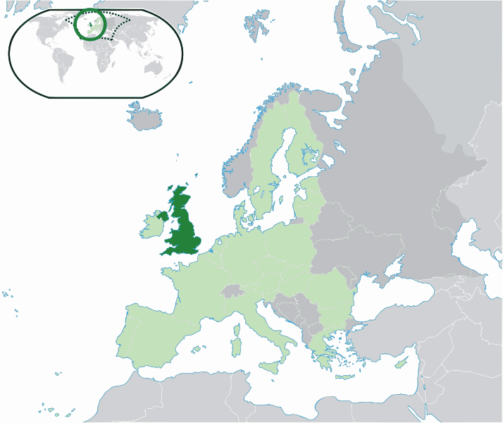
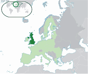
Location map: United Kingdom (dark green) / European Union (light green) / Europe (dark grey); inspired by and consistent with general country locator maps by User:Vardion, et al |
| Date | (UTC) |
| Source | Location UK EU Europe.png |
| Author |
Vector: |
| SVG development |
I, the copyright holder of this work, hereby publish it under the following license:
| I, the copyright holder of this work, release this work into the public domain. This applies worldwide. In some countries this may not be legally possible; if so: I grant anyone the right to use this work for any purpose, without any conditions, unless such conditions are required by law. |
Original upload log edit
This image is a derivative work of the following images:
- Location UK EU Europe.png licensed with PD-self
- 2008-07-10T03:47:21Z Pureditor 2048x1720 (267764 Bytes) Reverted to version as of 13:11, 4 July 2007
- 2008-06-23T18:04:48Z Ijanderson977 2048x1720 (423147 Bytes) minor
- 2007-07-04T13:11:06Z Quizimodo 2048x1720 (267764 Bytes) image (updated)
- 2007-07-04T13:03:31Z Quizimodo 2048x1720 (267750 Bytes) image (updated)
- 2007-06-30T04:14:27Z Quizimodo 2056x1727 (240132 Bytes) updated map w/blue coastlines, Anglesey
- 2007-06-18T01:01:12Z Quizimodo 2056x1710 (180431 Bytes) image (updated)
- 2007-06-17T10:56:17Z Quizimodo 2056x1710 (234175 Bytes) {{Information |Description=Location map: United Kingdom (dark green) / European Union (light green) / Europe (dark grey); inspired by and consistent with general country locator maps by User:Vardion, et al |Source=self-made |
Uploaded with derivativeFX
File history
Click on a date/time to view the file as it appeared at that time.
| Date/Time | Thumbnail | Dimensions | User | Comment | |
|---|---|---|---|---|---|
| current | 15:07, 16 July 2020 | | 2,185 × 1,835 (1.69 MB) | De728631 (talk | contribs) | added South Sudan to world map |
| 02:13, 25 February 2009 |  | 2,048 × 1,720 (2.05 MB) | PureCore (talk | contribs) | {{Information |Description=Location map: United Kingdom (dark green) / European Union (light green) / Europe (dark grey); inspired by and consistent with general country locator maps by User:Vardion, et al |Source=*File:Location_UK_EU_Europe.png |Da |
You cannot overwrite this file.
File usage on Commons
The following page uses this file:
File usage on other wikis
The following other wikis use this file:
- Usage on ja.wikibooks.org
- Usage on wuu.wikipedia.org