File:Location map Canada Vancouver.png
Size of this preview: 800 × 539 pixels. Other resolutions: 320 × 216 pixels | 640 × 431 pixels | 1,024 × 690 pixels | 1,265 × 852 pixels.
Original file (1,265 × 852 pixels, file size: 997 KB, MIME type: image/png)
Captions
Captions
Add a one-line explanation of what this file represents
Summary edit
| Description |
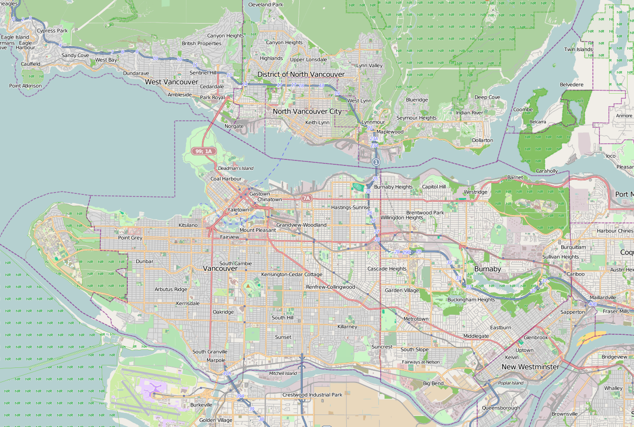
English: Map of Vancouver
Geographic limits of the map:
|
| Date | |
| Source | http://www.maps-for-free.com/ using Open Street Map data. |
| Author | Snapshot taken by Dr. Blofeld |
| Permission (Reusing this file) |
This file is licensed under the Creative Commons Attribution-Share Alike 3.0 Unported license. Attribution: Maps for Free
|
File history
Click on a date/time to view the file as it appeared at that time.
| Date/Time | Thumbnail | Dimensions | User | Comment | |
|---|---|---|---|---|---|
| current | 09:55, 23 April 2013 | | 1,265 × 852 (997 KB) | Blofeld Dr. (talk | contribs) | {{Information |Description ={{en|1=r}} |Source =r |Author =r |Date =r |Permission = |other_versions = }} |
You cannot overwrite this file.
File usage on Commons
There are no pages that use this file.
File usage on other wikis
The following other wikis use this file:
- Usage on ar.wikipedia.org
- Usage on ceb.wikipedia.org
- Usage on en.wikipedia.org
- Usage on fa.wikipedia.org
- Usage on fr.wikipedia.org
- Vancouver
- Université de la Colombie-Britannique
- Surrey (Colombie-Britannique)
- Rogers Arena
- Parc provincial Golden Ears
- Gare de Vancouver Waterfront
- BC Place
- Pacific Coliseum
- Stade Swangard
- Exposition spécialisée de 1986
- Pont Lions Gate
- Centre des sports d'hiver UBC
- Musée maritime de Vancouver
- Skybridge (Canada)
- Anneau olympique de Richmond
- Parc provincial Cypress
- Empire Field
- Vélodrome de Burnaby
- CIVT-DT
- Galerie d'art de Vancouver
- Modèle:Géolocalisation/Vancouver
- Chinatown (Vancouver)
- Queen Elizabeth Park (Vancouver)
- Consulat général de France à Vancouver
- Ponts de Port Mann
- Réserve nationale de faune d'Alaksen
- Nat Bailey Stadium
- Victoria Park (North Vancouver)
- Science World (Vancouver)
- Kitsilano
- Péninsule Burrard
- Baie des Anglais
- West Point Grey
- Downtown Vancouver
- Red Leafs de l'Université Simon Fraser
- Terrain Terry Fox
- Stade de l'Empire
- Centre d'Événements de Langley
- Mont Grouse
- Stade Thunderbird
- École secondaire University Hill
View more global usage of this file.