File:Location of Daxing'anling Prefecture within Heilongjiang (China).png
Size of this preview: 694 × 599 pixels. Other resolutions: 278 × 240 pixels | 556 × 480 pixels | 880 × 760 pixels.
Original file (880 × 760 pixels, file size: 102 KB, MIME type: image/png)
Captions
Captions
Add a one-line explanation of what this file represents
Summary edit
.png&action=edit§ion=1)
| Description |
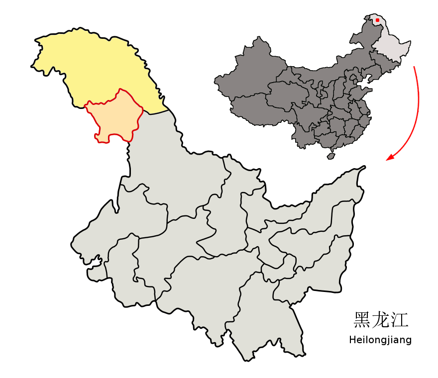
Location of Daxing'anling Prefecture (yellow) within Heilongjiang Province of China. This map includes Jiagedaqi and Songling Districts (light salmon) under Heilongjiang administration, although these territories nominally belong to Inner Mongolia. Map drawn in november 2007 using various sources, mainly : |
| Date | |
| Source | Own work |
| Author | Croquant |
Licensing edit
.png&action=edit§ion=2)
I, the copyright holder of this work, hereby publish it under the following license:
This file is licensed under the Creative Commons Attribution 3.0 Unported license.
- You are free:
- to share – to copy, distribute and transmit the work
- to remix – to adapt the work
- Under the following conditions:
- attribution – You must give appropriate credit, provide a link to the license, and indicate if changes were made. You may do so in any reasonable manner, but not in any way that suggests the licensor endorses you or your use.
File history
Click on a date/time to view the file as it appeared at that time.
| Date/Time | Thumbnail | Dimensions | User | Comment | |
|---|---|---|---|---|---|
| current | 20:17, 21 November 2007 | | 880 × 760 (102 KB) | Croquant (talk | contribs) | removed flaw |
| 15:49, 21 November 2007 |  | 880 × 760 (102 KB) | Croquant (talk | contribs) | ||
| 19:16, 19 November 2007 |  | 880 × 760 (100 KB) | Croquant (talk | contribs) | == Summary == {{Information |Description=Location of Daxing'anling Prefecture (yellow) within Heilongjiang Province of China Map drawn in november 2007 using various sources, mainly : * [http://sedac.ciesin.org/china/admin/bnd90/t2390.html Heilongjiang P |
You cannot overwrite this file.
File usage on Commons
The following page uses this file:
File usage on other wikis
The following other wikis use this file:
- Usage on da.wikipedia.org
- Usage on en.wikipedia.org
- Usage on et.wikipedia.org
- Usage on fi.wikipedia.org
- Usage on fr.wikipedia.org
- Usage on it.wikipedia.org
- Usage on no.wikipedia.org
- Usage on pl.wikipedia.org
- Usage on ur.wikipedia.org
.png&oldid=473018140)