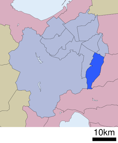
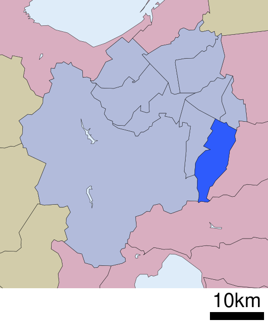
File:Location of Kiyota ward Sapporo city Hokkaido Japan.svg

Original file (SVG file, nominally 540 × 652 pixels, file size: 9 KB)
Captions
Captions
Summary edit
| Description |
English: Location of Kiyota-ku in Hokkaido prefecture, Japan
|
||
| Date | Uploaded by Lincun to Japanese Wikipedia in December 4th 2007. | ||
| Source | File:行政区位置図 01110.svg on Japanese Wikipedia | ||
| Author | Lincun | ||
| Permission (Reusing this file) |
|
Licensing edit

|
Permission is granted to copy, distribute and/or modify this document under the terms of the GNU Free Documentation License, Version 1.2 or any later version published by the Free Software Foundation; with no Invariant Sections, no Front-Cover Texts, and no Back-Cover Texts. A copy of the license is included in the section entitled GNU Free Documentation License. |
- You are free:
- to share – to copy, distribute and transmit the work
- to remix – to adapt the work
- Under the following conditions:
- attribution – You must give appropriate credit, provide a link to the license, and indicate if changes were made. You may do so in any reasonable manner, but not in any way that suggests the licensor endorses you or your use.
- share alike – If you remix, transform, or build upon the material, you must distribute your contributions under the same or compatible license as the original.
Original upload log edit
| This file was moved from Japanese Wikipedia.
See below for original file information. | ||||||||||||||||||||||||
| ||||||||||||||||||||||||
|
| ||||||||||||||||||||||||
File history
Click on a date/time to view the file as it appeared at that time.
| Date/Time | Thumbnail | Dimensions | User | Comment | |
|---|---|---|---|---|---|
| current | 12:42, 27 May 2009 | | 540 × 652 (9 KB) | LERK (talk | contribs) | {{User:LERK/Information-other-user-image |language-code=ja |language-name=Japanese |wikimedia-project=Wikipedia |des={{ja|清田区(日本国・北海道札幌市)の位置}} |file-name=行政区位置図 01110.svg |uploader-name=Lin |
You cannot overwrite this file.
File usage on Commons
The following 4 pages use this file:
File usage on other wikis
The following other wikis use this file:
- Usage on ar.wikipedia.org
- Usage on ca.wikipedia.org
- Usage on de.wikipedia.org
- Usage on en.wikipedia.org
- Usage on fa.wikipedia.org
- Usage on fr.wikipedia.org
- Usage on id.wikipedia.org
- Usage on ja.wikipedia.org
- Usage on ko.wikipedia.org
- Usage on uk.wikipedia.org
- Usage on www.wikidata.org
- Usage on zh.wikipedia.org