File:Lockheed ER-2 high altitude research aircraft (EC97-44304-9).jpg

Original file (3,000 × 2,400 pixels, file size: 3.61 MB, MIME type: image/jpeg)
Captions
Captions
Summary edit
| DescriptionLockheed ER-2 high altitude research aircraft (EC97-44304-9).jpg |
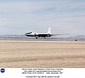
English: ER-2 tail number 706, was one of two Airborne Science ER-2s used as science platforms by Dryden. The aircraft were platforms for a variety of high-altitude science missions flown over various parts of the world. They were also used for earth science and atmospheric sensor research and development, satellite calibration and data validation. |
| Date | |
| Source | https://www.dfrc.nasa.gov/Gallery/Photo/ER-2/HTML/EC97-44304-9.html |
| Author | NASA/DFRC |
This image or video was catalogued by Armstrong Flight Research Center of the United States National Aeronautics and Space Administration (NASA) under Photo ID: EC97-44304-9. This tag does not indicate the copyright status of the attached work. A normal copyright tag is still required. See Commons:Licensing. Other languages:
العربية ∙ беларуская (тарашкевіца) ∙ български ∙ català ∙ čeština ∙ dansk ∙ Deutsch ∙ English ∙ español ∙ فارسی ∙ français ∙ galego ∙ magyar ∙ հայերեն ∙ Bahasa Indonesia ∙ italiano ∙ 日本語 ∙ македонски ∙ മലയാളം ∙ Nederlands ∙ polski ∙ português ∙ русский ∙ sicilianu ∙ slovenščina ∙ Türkçe ∙ українська ∙ 简体中文 ∙ 繁體中文 ∙ +/− |
Licensing edit
| Public domainPublic domainfalsefalse |
| This file is in the public domain in the United States because it was solely created by NASA. NASA copyright policy states that "NASA material is not protected by copyright unless noted". (See Template:PD-USGov, NASA copyright policy page or JPL Image Use Policy.) |  | |
 |
Warnings:
|
File history
Click on a date/time to view the file as it appeared at that time.
| Date/Time | Thumbnail | Dimensions | User | Comment | |
|---|---|---|---|---|---|
| current | 13:55, 8 October 2019 |  | 3,000 × 2,400 (3.61 MB) | Huntster (talk | contribs) | Cropped 13 % vertically using CropTool with lossless mode. |
| 13:53, 8 October 2019 |  | 3,000 × 2,750 (3.77 MB) | Huntster (talk | contribs) | {{Information |Description={{en|1=ER-2 tail number 706, was one of two Airborne Science ER-2s used as science platforms by Dryden. The aircraft were platforms for a variety of high-altitude science missions flown over various parts of the world. They were also used for earth science and atmospheric sensor research and development, satellite calibration and data validation.}} |Source=https://www.dfrc.nasa.gov/Gallery/Photo/ER-2/HTML/EC97-44304-9.html |Date=1997-12 |Author=NASA/DFRC |Permission... |
You cannot overwrite this file.
File usage on Commons
The following 2 pages use this file:
Metadata
This file contains additional information such as Exif metadata which may have been added by the digital camera, scanner, or software program used to create or digitize it. If the file has been modified from its original state, some details such as the timestamp may not fully reflect those of the original file. The timestamp is only as accurate as the clock in the camera, and it may be completely wrong.
| JPEG file comment | NASA Dryden Flight Research Center Photo Collection
http://www.dfrc.nasa.gov/gallery/photo/index.html NASA Photo: EC97-44304-9 Date: December 1997 Lockheed ER-2 high altitude research aircraft |
|---|