File:London Victoria Rail Status Diagram, Line Level Display.jpg

Size of this preview: 800 × 493 pixels. Other resolutions: 320 × 197 pixels | 640 × 394 pixels | 1,024 × 631 pixels | 1,280 × 788 pixels | 2,560 × 1,576 pixels | 3,456 × 2,128 pixels.
Original file (3,456 × 2,128 pixels, file size: 2.92 MB, MIME type: image/jpeg)
Captions
Captions
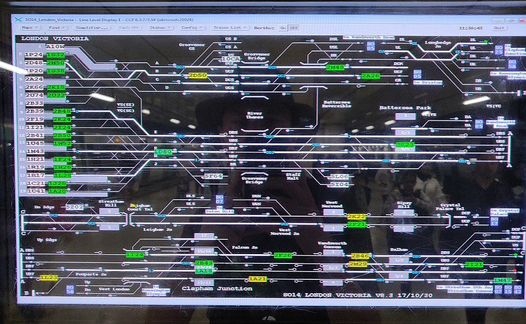
London Victoria Rail Status Diagram, Line Level Display
Summary
edit
| Description |
English: Line Level Display, CFF |
| Date | |
| Source | https://www.flickr.com/photos/tim_uk/48331501356/ |
| Author | Tim Sheerman-Chase |
| Camera location | | View this and other nearby images on: OpenStreetMap |
|---|
Licensing
edit
This file is licensed under the Creative Commons Attribution 2.0 Generic license.
- You are free:
- to share – to copy, distribute and transmit the work
- to remix – to adapt the work
- Under the following conditions:
- attribution – You must give appropriate credit, provide a link to the license, and indicate if changes were made. You may do so in any reasonable manner, but not in any way that suggests the licensor endorses you or your use.
| This image was originally posted to Flickr by Tim Sheerman-Chase at https://flickr.com/photos/68932647@N00/48331501356. It was reviewed on 31 May 2022 by FlickreviewR 2 and was confirmed to be licensed under the terms of the cc-by-2.0. |
File history
Click on a date/time to view the file as it appeared at that time.
| Date/Time | Thumbnail | Dimensions | User | Comment | |
|---|---|---|---|---|---|
| current | 14:44, 31 May 2022 | | 3,456 × 2,128 (2.92 MB) | TimSC (talk | contribs) | Uploaded a work by Tim Sheerman-Chase from https://www.flickr.com/photos/tim_uk/48331501356/ with UploadWizard |
You cannot overwrite this file.
File usage on Commons
The following page uses this file: