File:Lorenaberge topografisch.jpg

Size of this preview: 770 × 600 pixels. Other resolutions: 308 × 240 pixels | 616 × 480 pixels | 986 × 768 pixels | 1,280 × 997 pixels | 1,723 × 1,342 pixels.
Original file (1,723 × 1,342 pixels, file size: 1.18 MB, MIME type: image/jpeg)
Captions
Captions
Add a one-line explanation of what this file represents
Summary edit
| Description |
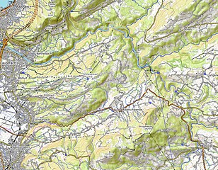
Deutsch: Schneiderkopf, Brüggelekopf, Geißkopf, oben noch Teile des Pfänderstocks und des Sulzbergs |
| Date | |
| Source | https://www.openstreetmap.org/copyright |
| Author | Openstreetmap Mitwirkende |
Licensing edit
This file is licensed under the Creative Commons Attribution 4.0 International license.
- You are free:
- to share – to copy, distribute and transmit the work
- to remix – to adapt the work
- Under the following conditions:
- attribution – You must give appropriate credit, provide a link to the license, and indicate if changes were made. You may do so in any reasonable manner, but not in any way that suggests the licensor endorses you or your use.
| Annotations | This image is annotated: View the annotations at Commons |
File history
Click on a date/time to view the file as it appeared at that time.
| Date/Time | Thumbnail | Dimensions | User | Comment | |
|---|---|---|---|---|---|
| current | 20:26, 9 January 2024 | | 1,723 × 1,342 (1.18 MB) | Robinhood50 (talk | contribs) | Uploaded a work by Openstreetmap Mitwirkende from https://www.openstreetmap.org/copyright with UploadWizard |
You cannot overwrite this file.
File usage on Commons
The following page uses this file:
File usage on other wikis
The following other wikis use this file:
- Usage on de.wikipedia.org