File:Lower Mainland of British Columbia, 2012.jpg

Size of this preview: 800 × 419 pixels. Other resolutions: 320 × 168 pixels | 640 × 335 pixels | 1,024 × 536 pixels | 1,280 × 670 pixels | 2,560 × 1,341 pixels | 4,200 × 2,200 pixels.
Original file (4,200 × 2,200 pixels, file size: 3.01 MB, MIME type: image/jpeg)
Captions
Captions
BC's southern region
Summary edit
| Description |
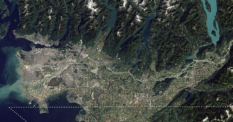
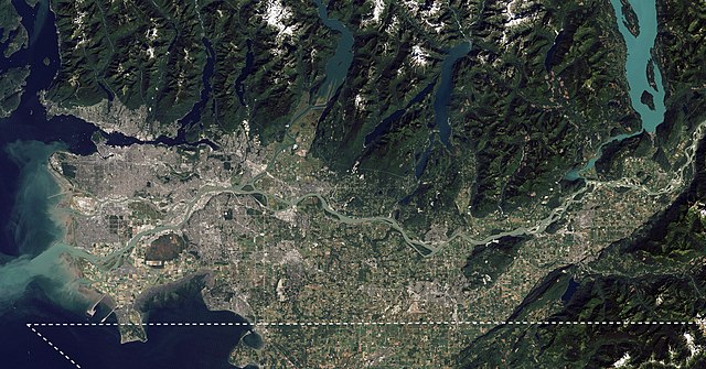
English: I took NASA's beautiful satellite image of the Fraser Lowland from 2012 and cropped into the core area of the Lower Mainland. I also added an approximate Canada-US border line meant for visual reference. This image is meant to replace an older satellite image that outlining the Lower Mainland in red. |
| Date | |
| Source | The Big Muddy, Western Edition |
| Author | NASA Goddard Space Flight Center from Greenbelt, MD, USA |
| Other versions |
.jpg) |
Licensing edit
| This image, originally posted to Flickr, was reviewed on 6 September 2020 by the administrator or reviewer Leoboudv, who confirmed that it was available on Flickr under the stated license on that date. |
This file is licensed under the Creative Commons Attribution 2.0 Generic license.
- You are free:
- to share – to copy, distribute and transmit the work
- to remix – to adapt the work
- Under the following conditions:
- attribution – You must give appropriate credit, provide a link to the license, and indicate if changes were made. You may do so in any reasonable manner, but not in any way that suggests the licensor endorses you or your use.
| Annotations | This image is annotated: View the annotations at Commons |
File history
Click on a date/time to view the file as it appeared at that time.
| Date/Time | Thumbnail | Dimensions | User | Comment | |
|---|---|---|---|---|---|
| current | 23:14, 4 September 2020 | | 4,200 × 2,200 (3.01 MB) | Ponderosapine210 (talk | contribs) | Uploaded a work by [https://www.flickr.com/people/24662369@N07 NASA Goddard Space Flight Center] from Greenbelt, MD, USA from [https://www.flickr.com/photos/gsfc/6987590721/ The Big Muddy, Western Edition] with UploadWizard |
You cannot overwrite this file.
File usage on Commons
The following 3 pages use this file:
File usage on other wikis
The following other wikis use this file:
- Usage on ca.wikipedia.org
- Usage on en.wikipedia.org
- Usage on eo.wikipedia.org
- Usage on es.wikipedia.org
- Usage on fa.wikipedia.org
- Usage on fy.wikipedia.org
- Usage on it.wikivoyage.org
- Usage on te.wikipedia.org
- Usage on uk.wikipedia.org
- Usage on www.wikidata.org
- Usage on zh.wikipedia.org