File:Lower Nihotupu Dam and Manukau Harbour (cropped to Parau).jpg

Size of this preview: 800 × 534 pixels. Other resolutions: 320 × 214 pixels | 640 × 427 pixels | 1,024 × 683 pixels | 1,461 × 975 pixels.
Original file (1,461 × 975 pixels, file size: 577 KB, MIME type: image/jpeg)
Captions
Captions
Add a one-line explanation of what this file represents
Summary edit
| Description |
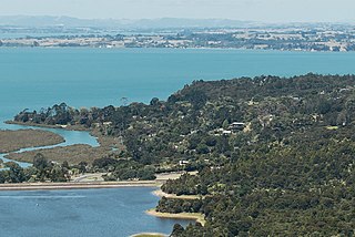
English: View of the Lower Nihotupu Dam and Manukau Harbour from the Arataki Visitor Centre |
| Date | |
| Source | https://www.flickr.com/photos/virtualwolf/49540057716/ |
| Author | VirtualWolf |
| Other versions |

.jpg&action=edit§ion=1)
| Camera location | | View this and other nearby images on: OpenStreetMap |
|---|
.jpg¶ms=-36.947020_N_0174.606777_E_globe:Earth_type:camera__&language=en)
Licensing edit
.jpg&action=edit§ion=2)
This file is licensed under the Creative Commons Attribution-Share Alike 2.0 Generic license.
- You are free:
- to share – to copy, distribute and transmit the work
- to remix – to adapt the work
- Under the following conditions:
- attribution – You must give appropriate credit, provide a link to the license, and indicate if changes were made. You may do so in any reasonable manner, but not in any way that suggests the licensor endorses you or your use.
- share alike – If you remix, transform, or build upon the material, you must distribute your contributions under the same or compatible license as the original.
File history
Click on a date/time to view the file as it appeared at that time.
| Date/Time | Thumbnail | Dimensions | User | Comment | |
|---|---|---|---|---|---|
| current | 21:16, 7 May 2022 | | 1,461 × 975 (577 KB) | Prosperosity (talk | contribs) | File:Lower Nihotupu Dam and Manukau Harbour.jpg cropped 78 % horizontally, 78 % vertically using CropTool with lossless mode. |
You cannot overwrite this file.
File usage on Commons
The following 2 pages use this file:
File usage on other wikis
The following other wikis use this file:
.jpg&oldid=836582160)