File:Lower course of Garrison Creek, 1818.jpg
Lower_course_of_Garrison_Creek,_1818.jpg (185 × 204 pixels, file size: 34 KB, MIME type: image/jpeg)
Captions
Captions
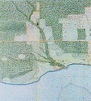
| Description | 1818_map_of_York,_Upper_Canada. |
| Date | (UTC) |
| Source | |
| Author |
|
| This is a retouched picture, which means that it has been digitally altered from its original version. Modifications: cropped. The original can be viewed here: 1818 map of York, Upper Canada.jpg:
|
This Canadian work is in the public domain in Canada because its copyright has expired due to one of the following:
it was not subject to Crown copyright, and
|
 |
Original upload log edit
This image is a derivative work of the following images:
- File:1818_map_of_York,_Upper_Canada.jpg licensed with PD-Canada
- 2009-10-18T01:13:01Z Geo Swan 406x351 (51149 Bytes) {{Information |Description=1818_map_of_York,_Upper_Canada. |Source=http://www.rbebout.com/queen/2pline.htm |Date=1818 |Author=unknown |Permission={{PD-Canada}} |other_versions= }} [[Category:Toronto Waterfront]] [[Category:Yo
Uploaded with derivativeFX
File history
Click on a date/time to view the file as it appeared at that time.
| Date/Time | Thumbnail | Dimensions | User | Comment | |
|---|---|---|---|---|---|
| current | 08:34, 27 February 2011 | | 185 × 204 (34 KB) | Geo Swan (talk | contribs) | {{Information |Description=1818_map_of_York,_Upper_Canada. |Source=*File:1818_map_of_York,_Upper_Canada.jpg |Date=2011-02-27 08:27 (UTC) |Author=*File:1818_map_of_York,_Upper_Canada.jpg: {{unknown}} *derivative work: ~~~ |Permission= |other_ve |
You cannot overwrite this file.
File usage on Commons
The following page uses this file:
File usage on other wikis
The following other wikis use this file:
- Usage on ceb.wikipedia.org
- Usage on www.wikidata.org