File:Lucania da The Historical Atlas, by William R. Shepherd, 1911.png
Size of this preview: 800 × 569 pixels. Other resolutions: 320 × 228 pixels | 640 × 455 pixels | 911 × 648 pixels.
Original file (911 × 648 pixels, file size: 3.47 MB, MIME type: image/png)
Captions
Captions
Add a one-line explanation of what this file represents
Summary edit
| Description |
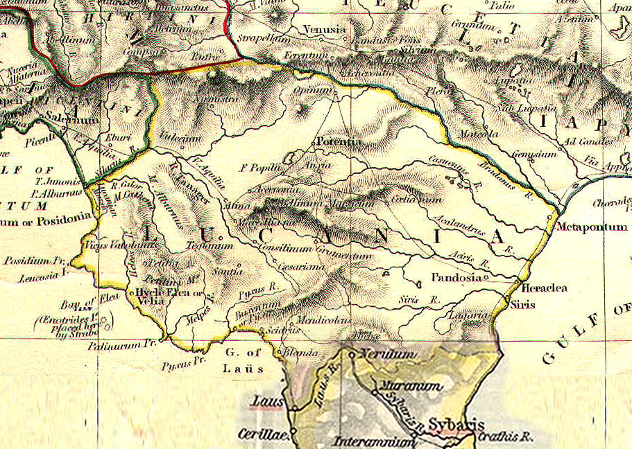
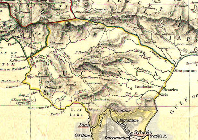
English: Reference map for Roman Lucania from The Historical Atlas by William R. Shepherd, 1911 (Some particular of the soutern part of the map elaborated for integration)
Italiano: Mappa di riferimento per la Lucania romana da The Historical Atlas di William R. Shepherd, 1911 (Alcuni particolari della parte sud della mappa sono stati rielaborati per integrazione) |
| Date | Unknown date |
| Source | Own work |
| Author | GlióPanteco |
Licensing edit
| I, the copyright holder of this work, release this work into the public domain. This applies worldwide. In some countries this may not be legally possible; if so: I grant anyone the right to use this work for any purpose, without any conditions, unless such conditions are required by law. |
File history
Click on a date/time to view the file as it appeared at that time.
| Date/Time | Thumbnail | Dimensions | User | Comment | |
|---|---|---|---|---|---|
| current | 14:07, 9 January 2009 | | 911 × 648 (3.47 MB) | GlióPanteco (talk | contribs) | {{Information |Description={{en|1=Reference map for Roman Lucania from ''The Historical Atlas'' by William R. Shepherd, 1911 (Some particular of the soutern part of the map elaborated for integration)}} {{it|1=Mappa di riferimento per la Lucania romana da |
You cannot overwrite this file.
File usage on Commons
The following page uses this file:
File usage on other wikis
The following other wikis use this file:
- Usage on br.wikipedia.org
- Usage on de.wikipedia.org
- Usage on en.wikipedia.org
- Usage on fr.wikipedia.org
- Usage on he.wikipedia.org
- Usage on it.wikipedia.org
- Usage on pt.wikipedia.org