File:Luchtopname van de Nieuwe Maas, Willemsbrug, Willemsspoorbrug, Boompjes, Scheepmakershaven, Wijnhaven, Korte Wijnbrug, Oudehaven, Witte Huis, Koningsbrug, Luchtspoor, Sint-Laurenskerk, Nieuwehaven en Haringsvliet 1945.jpg

Size of this preview: 800 × 541 pixels. Other resolutions: 320 × 216 pixels | 640 × 433 pixels | 1,024 × 692 pixels | 1,280 × 865 pixels | 2,560 × 1,730 pixels | 4,420 × 2,987 pixels.
Original file (4,420 × 2,987 pixels, file size: 5.35 MB, MIME type: image/jpeg)
Captions
Captions
Add a one-line explanation of what this file represents
Summary edit
| Description |
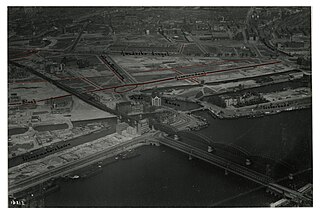
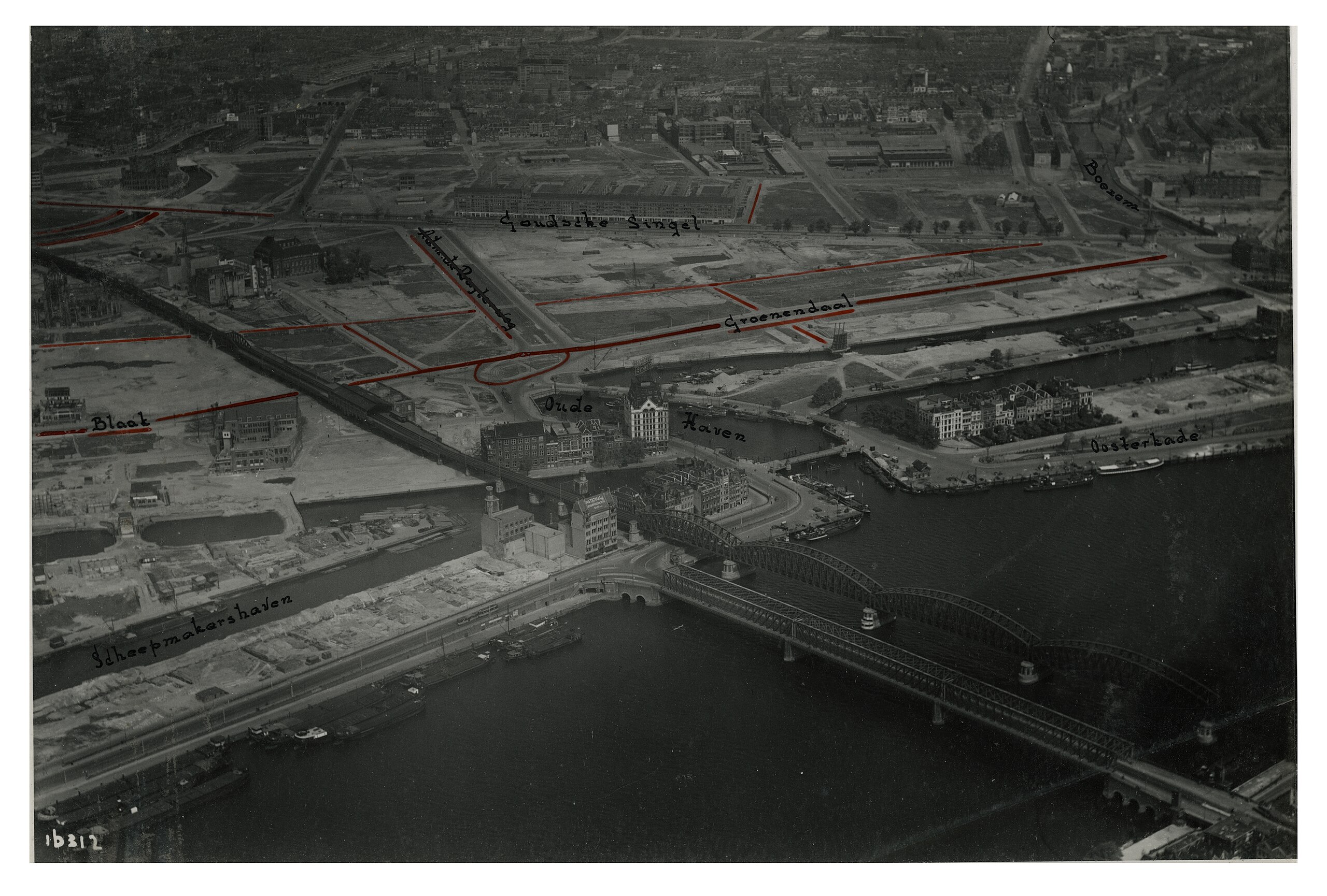
English: Aerial view of the surroundings of the Oudehaven and the Witte Huis, with the Scheepmakershaven and the Blaak on the left, in the background in the middle Admiraal de Ruyterweg, the Goudsesingel, and the Groenendaal, and on the right the Oosterkade and in the foreground the Maasbruggen over the Nieuwe Maas. Year: 1945.
Nederlands: Luchtopname van de omgeving van de Oudehaven en het Witte Huis, met links de Scheepmakershaven en de Blaak, op de achtergrond in het midden Admiraal de Ruyterweg, de Goudsesingel, en het Groenendaal, en rechts de Oosterkade en op de voorgrond de Maasbruggen over de Nieuwe Maas. Jaar: 1945. |
| Date | |
| Source | Stadsarchief Rotterdam |
| Author | KLM Aerocarto |
Licensing edit
| This file is made available under the Creative Commons CC0 1.0 Universal Public Domain Dedication. | |
| The person who associated a work with this deed has dedicated the work to the public domain by waiving all of their rights to the work worldwide under copyright law, including all related and neighboring rights, to the extent allowed by law. You can copy, modify, distribute and perform the work, even for commercial purposes, all without asking permission.
|
File history
Click on a date/time to view the file as it appeared at that time.
| Date/Time | Thumbnail | Dimensions | User | Comment | |
|---|---|---|---|---|---|
| current | 19:38, 6 July 2023 | | 4,420 × 2,987 (5.35 MB) | MatteoNL97 (talk | contribs) | Uploaded a work by KLM Aerocarto from [https://hdl.handle.net/21.12133/500B09ADE90548BC89F6CA7446B7B195 Stadsarchief Rotterdam] with UploadWizard |
You cannot overwrite this file.
File usage on Commons
There are no pages that use this file.