File:Luftbild Verzweigung Gellert.jpg

Size of this preview: 800 × 552 pixels. Other resolutions: 320 × 221 pixels | 640 × 441 pixels | 1,024 × 706 pixels | 1,280 × 882 pixels | 2,560 × 1,765 pixels | 3,081 × 2,124 pixels.
Original file (3,081 × 2,124 pixels, file size: 6.54 MB, MIME type: image/jpeg)
Captions
Captions
Add a one-line explanation of what this file represents
Summary edit
| Description |
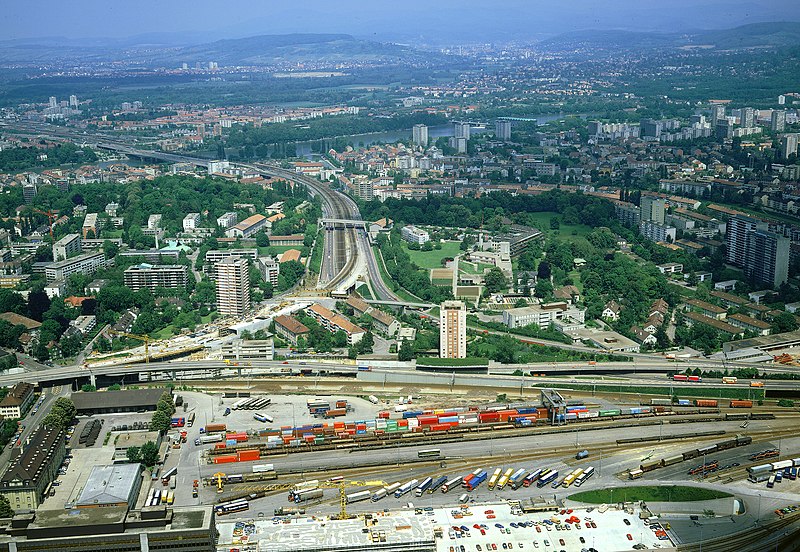
Deutsch: Luftbild der Verzweigung Gellert, Basel, etwa ein halbes Jahr vor seiner Fertigstellung (von südlicher Richtung) |
|||
| Date | ||||
| Source |
|
|||
| Author | Comet Photo AG (Zürich) |

| Object location | | View this and other nearby images on: OpenStreetMap |
|---|
Licensing edit
I, the copyright holder of this work, hereby publish it under the following license:
This file is licensed under the Creative Commons Attribution 4.0 International license.
- You are free:
- to share – to copy, distribute and transmit the work
- to remix – to adapt the work
- Under the following conditions:
- attribution – You must give appropriate credit, provide a link to the license, and indicate if changes were made. You may do so in any reasonable manner, but not in any way that suggests the licensor endorses you or your use.
| Annotations | This image is annotated: View the annotations at Commons |
File history
Click on a date/time to view the file as it appeared at that time.
| Date/Time | Thumbnail | Dimensions | User | Comment | |
|---|---|---|---|---|---|
| current | 15:10, 4 May 2022 | | 3,081 × 2,124 (6.54 MB) | Alabasterstein (talk | contribs) | {{Information |Description=Luftbild der Verzweigung Gellert, Basel |Source={{Template:ETH-Bibliothek}} http://doi.org/10.3932/ethz-a-000040660 |Date=5/1985 |Author= Comet Photo AG (Zürich) |Permission= |other_versions= }} == {{int:license-header}} == {{self|cc-by-4.0}} Category:Verzweigung Gellert |
You cannot overwrite this file.
File usage on Commons
The following page uses this file:
File usage on other wikis
The following other wikis use this file:
- Usage on de.wikipedia.org
- Usage on www.wikidata.org