File:MACAUBUS ROUTEMAP 25B.png

Size of this preview: 337 × 599 pixels. Other resolutions: 135 × 240 pixels | 270 × 480 pixels | 432 × 768 pixels | 1,080 × 1,920 pixels.
Original file (1,080 × 1,920 pixels, file size: 387 KB, MIME type: image/png)
Captions
Captions
Add a one-line explanation of what this file represents
Summary edit
| Description |
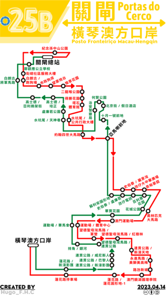
中文(澳門):澳門巴士25B路線的走線圖 |
| Date | |
| Source | Own work |
| Author | Hugo F.H.C |
Licensing edit
I, the copyright holder of this work, hereby publish it under the following license:
This file is licensed under the Creative Commons Attribution-Share Alike 4.0 International license.
- You are free:
- to share – to copy, distribute and transmit the work
- to remix – to adapt the work
- Under the following conditions:
- attribution – You must give appropriate credit, provide a link to the license, and indicate if changes were made. You may do so in any reasonable manner, but not in any way that suggests the licensor endorses you or your use.
- share alike – If you remix, transform, or build upon the material, you must distribute your contributions under the same or compatible license as the original.
File history
Click on a date/time to view the file as it appeared at that time.
| Date/Time | Thumbnail | Dimensions | User | Comment | |
|---|---|---|---|---|---|
| current | 17:33, 13 April 2023 | | 1,080 × 1,920 (387 KB) | Hugo F.H.C (talk | contribs) | 路線圖更新 |
| 17:51, 3 December 2022 |  | 1,587 × 2,245 (574 KB) | Hugo F.H.C (talk | contribs) | 路線圖更新 | |
| 05:58, 22 August 2022 |  | 1,587 × 2,245 (544 KB) | Hugo F.H.C (talk | contribs) | 路線圖更新 | |
| 08:39, 7 July 2022 |  | 1,587 × 2,245 (538 KB) | Hugo F.H.C (talk | contribs) | Uploaded own work with UploadWizard |
You cannot overwrite this file.
File usage on Commons
The following 9 pages use this file:
- User:Chumwa/OgreBot/Public transport information/2022 August 21-31
- User:Chumwa/OgreBot/Public transport information/2022 December 1-10
- User:Chumwa/OgreBot/Public transport information/2023 April 11-20
- User:Chumwa/OgreBot/Transport Maps/2022 August 21-31
- User:Chumwa/OgreBot/Transport Maps/2022 December 1-10
- User:Chumwa/OgreBot/Transport Maps/2023 April 11-20
- User:Chumwa/OgreBot/Travel and communication maps/2022 August 21-31
- User:Chumwa/OgreBot/Travel and communication maps/2022 December 1-10
- User:Chumwa/OgreBot/Travel and communication maps/2023 April 11-20
File usage on other wikis
The following other wikis use this file:
- Usage on zh.wikipedia.org