File:MEIKO EAST BRIDGE CCB20072-C9-37.jpg

Size of this preview: 800 × 540 pixels. Other resolutions: 320 × 216 pixels | 640 × 432 pixels | 1,024 × 691 pixels | 1,280 × 863 pixels | 2,166 × 1,461 pixels.
Original file (2,166 × 1,461 pixels, file size: 2.56 MB, MIME type: image/jpeg)
Captions
Captions
Add a one-line explanation of what this file represents
Summary edit
| Description |
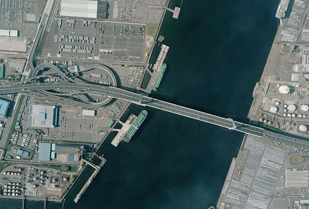
日本語: 名古屋港潮見ふ頭と新宝ふ頭間に架かる名港東大橋と潮見ふ頭の名港潮見インターチェンジ。 |
| Date | |
| Source | 国土画像情報(カラー空中写真)(整理番号:CCB20072、コース番号:C9、写真番号:37、撮影年月日:2007年5月22日、撮影地域:名古屋、撮影高度:1531m、撮影縮尺:1/10000、カメラ名称:RC30、焦点距離:153.100mm、カラー種別:カラー、写真種別:デジタル、撮影計画機関:国土地理院、市区町村名:名古屋市港区) |
| Author | 国土地理院 |
Licensing edit

|
The copyright holder of this file, the Ministry of Land, Infrastructure, Transport and Tourism of Japan, allows anyone to use it for any purpose, provided that the copyright holder is properly attributed. Redistribution, derivative work, commercial use, and all other use is permitted. |
Attribution:
Copyright © National Land Image Information (Color Aerial Photographs), Ministry of Land, Infrastructure, Transport and Tourism
|
 |
This image is copyrighted by the Ministry of Land, Infrastructure, Transport and Tourism of Japan. For terms of use, see the stipulation to use of National Land Information (in Japanese) and message from MLIT (in Japanese and English). When you display this image on an article, include the following phrase in the description: "Made based on National Land Image Information (Color Aerial Photographs), Ministry of Land, Infrastructure, Transport and Tourism".
|
File history
Click on a date/time to view the file as it appeared at that time.
| Date/Time | Thumbnail | Dimensions | User | Comment | |
|---|---|---|---|---|---|
| current | 18:40, 10 November 2017 | | 2,166 × 1,461 (2.56 MB) | Oka21000 (talk | contribs) | {{Information |Description ={{ja|1=名古屋港潮見ふ頭と新宝ふ頭間に架かる名港東大橋と潮見ふ頭の名港潮見インターチェンジ。}} |Source =国土画像情報(カラー空中写真)(整理番号:CCB20... |
You cannot overwrite this file.
File usage on Commons
The following page uses this file:
File usage on other wikis
The following other wikis use this file:
- Usage on ja.wikipedia.org