File:MKT 803N wagon 3 na środku drogi krajowej nr 1 w Zgierzu.jpg
Size of this preview: 800 × 525 pixels. Other resolutions: 320 × 210 pixels | 640 × 420 pixels | 1,024 × 672 pixels | 1,280 × 840 pixels | 2,560 × 1,679 pixels | 7,141 × 4,684 pixels.
Original file (7,141 × 4,684 pixels, file size: 5.47 MB, MIME type: image/jpeg)
Captions
Captions
Add a one-line explanation of what this file represents
Summary edit
| Camera location | | View this and other nearby images on: OpenStreetMap |
|---|
| Description |
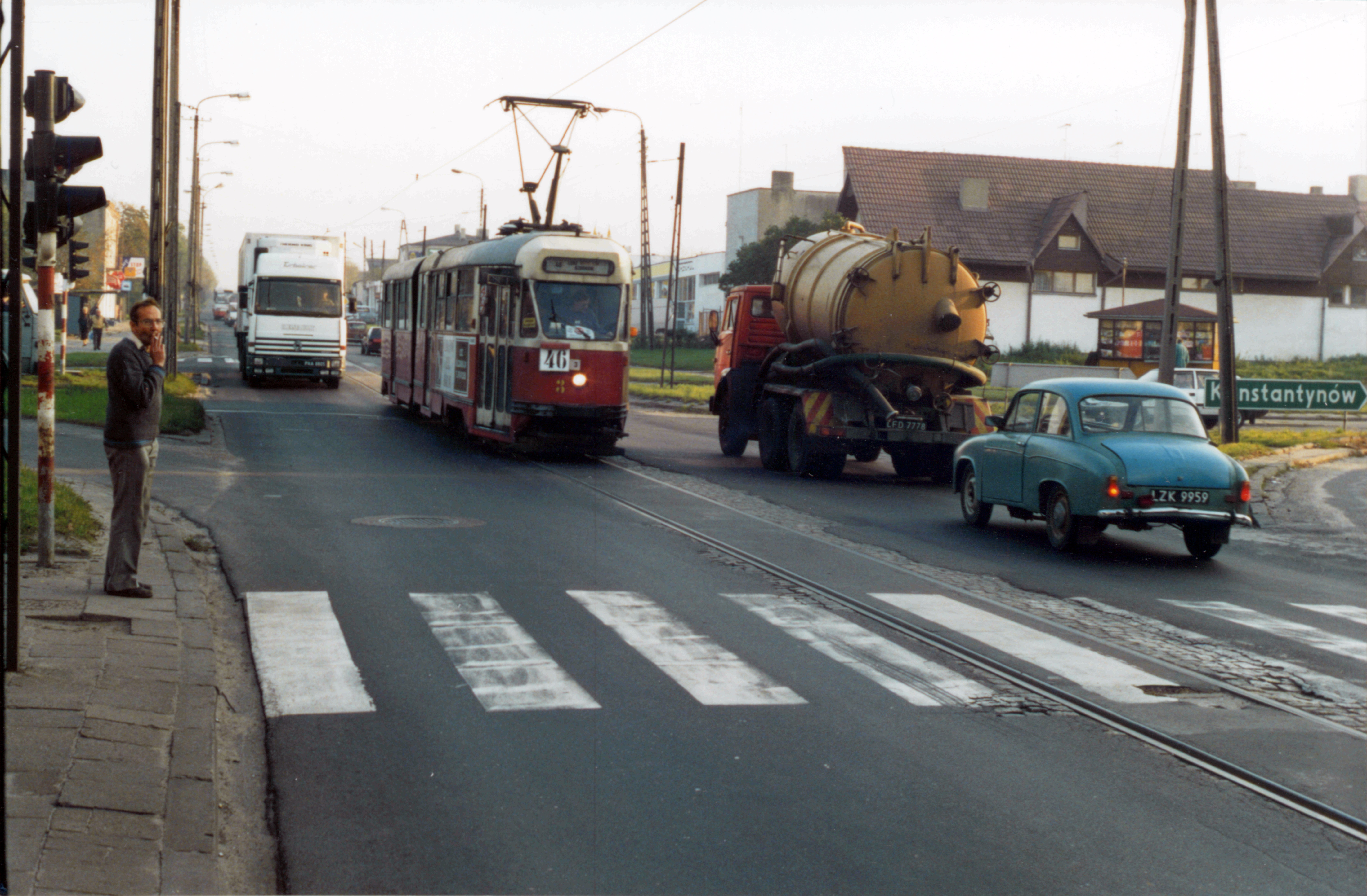
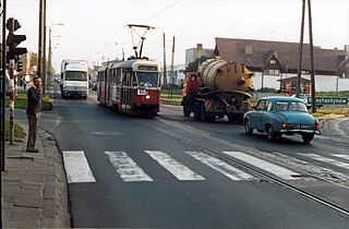
English: Tram line 46 on the national road No. 1 in Zgierz, Poland (part of the european route E75). In early 1996 the road closed for modernization. Tram wagon Konstal 803N side number 3 belongs to Międzygminna Komunikacja Tramwajowa Sp z o.o. in Łódź. Polski: Ulica Łódzka w Zgierzu. Tramwaj linii 46 jadący środkiem drogi krajowej nr 1 (fragment międzynarodowego szlaku komunikacyjnego E75). W początku 1996 roku droga zamknięta do przebudowy. Wagon Konstal 803N o numerze bocznym 3 należy do Międzygminnej Komunikacji Tramwajowej Sp. z o.o. w Łodzi. |
| Date | |
| Source | Own work |
| Author | Adam Zamojski |
Licensing edit
I, the copyright holder of this work, hereby publish it under the following license:
This file is licensed under the Creative Commons Attribution-Share Alike 3.0 Unported license.
- You are free:
- to share – to copy, distribute and transmit the work
- to remix – to adapt the work
- Under the following conditions:
- attribution – You must give appropriate credit, provide a link to the license, and indicate if changes were made. You may do so in any reasonable manner, but not in any way that suggests the licensor endorses you or your use.
- share alike – If you remix, transform, or build upon the material, you must distribute your contributions under the same or compatible license as the original.
File history
Click on a date/time to view the file as it appeared at that time.
| Date/Time | Thumbnail | Dimensions | User | Comment | |
|---|---|---|---|---|---|
| current | 13:51, 7 December 2011 | | 7,141 × 4,684 (5.47 MB) | Sanurss (talk | contribs) |
You cannot overwrite this file.
File usage on Commons
The following page uses this file:
File usage on other wikis
The following other wikis use this file:
- Usage on en.wikipedia.org
- Usage on pl.wikipedia.org
- Usage on sk.wikipedia.org