File:MOUTMARKA Færder nasjonalpark Tønsbergfjorden 2023-10-11 (Tjøme Oslofjorden Norway) Svaberg Fjære Hav Vind Bølger Sjøsprøyt Mot nord Kveldslys (Rocky coastline Archipelago Wind Waves Turbulent Sea spray splash Low sun) IMG 3170.jpg

Size of this preview: 800 × 600 pixels. Other resolutions: 320 × 240 pixels | 640 × 480 pixels | 1,024 × 768 pixels | 1,280 × 960 pixels | 2,560 × 1,920 pixels | 8,064 × 6,048 pixels.
Original file (8,064 × 6,048 pixels, file size: 10.34 MB, MIME type: image/jpeg)
Captions
Captions
Add a one-line explanation of what this file represents
Summary edit
_Svaberg_Fj%C3%A6re_Hav_Vind_B%C3%B8lger_Sj%C3%B8spr%C3%B8yt_Mot_nord_Kveldslys_(Rocky_coastline_Archipelago_Wind_Waves_Turbulent_Sea_spray_splash_Low_sun)_IMG_3170.jpg&action=edit§ion=1)
| Description |
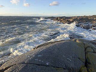
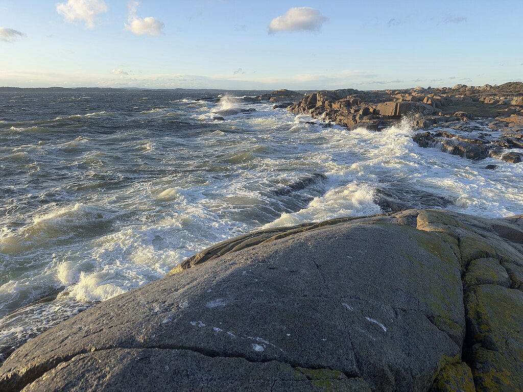
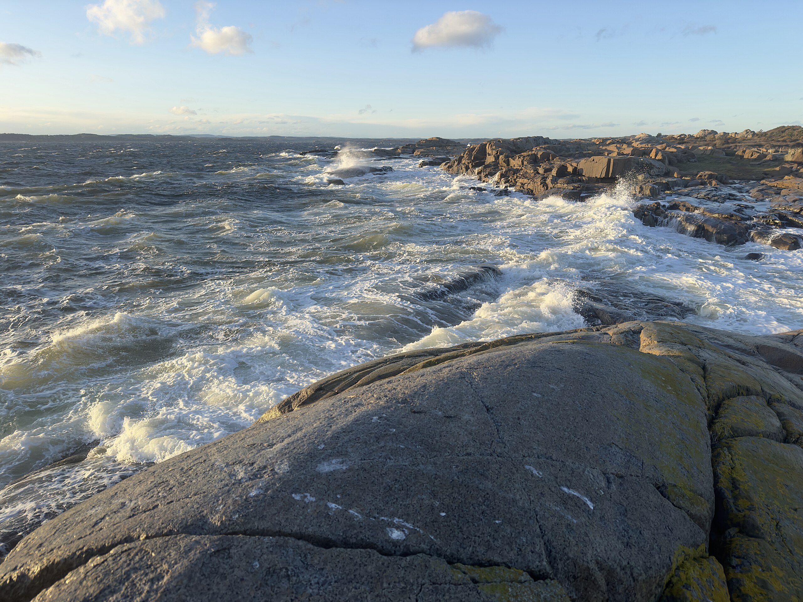
English: Picture from a series of photographs from the recreational hiking area at Moutmarka in the Færder National Park on the southwest of the island Tjøme on the western side of the Outer Oslo Fjord, Norway.
Norsk bokmål: Bilde fra en serie fotografier fra Moutmarka frilufts- og turområde, en del av Færder nasjonalpark sørvest på øya Tjøme på vestsida av Ytre Oslofjord.
|
| Date | |
| Source | Own work |
| Author | Wolfmann |
Licensing edit
_Svaberg_Fj%C3%A6re_Hav_Vind_B%C3%B8lger_Sj%C3%B8spr%C3%B8yt_Mot_nord_Kveldslys_(Rocky_coastline_Archipelago_Wind_Waves_Turbulent_Sea_spray_splash_Low_sun)_IMG_3170.jpg&action=edit§ion=2)
I, the copyright holder of this work, hereby publish it under the following license:
This file is licensed under the Creative Commons Attribution-Share Alike 4.0 International license.
- You are free:
- to share – to copy, distribute and transmit the work
- to remix – to adapt the work
- Under the following conditions:
- attribution – You must give appropriate credit, provide a link to the license, and indicate if changes were made. You may do so in any reasonable manner, but not in any way that suggests the licensor endorses you or your use.
- share alike – If you remix, transform, or build upon the material, you must distribute your contributions under the same or compatible license as the original.
File history
Click on a date/time to view the file as it appeared at that time.
| Date/Time | Thumbnail | Dimensions | User | Comment | |
|---|---|---|---|---|---|
| current | 17:21, 13 October 2023 | | 8,064 × 6,048 (10.34 MB) | Wolfmann (talk | contribs) | Uploaded own work with UploadWizard |
You cannot overwrite this file.
File usage on Commons
There are no pages that use this file.
_Svaberg_Fjære_Hav_Vind_Bølger_Sjøsprøyt_Mot_nord_Kveldslys_(Rocky_coastline_Archipelago_Wind_Waves_Turbulent_Sea_spray_splash_Low_sun)_IMG_3170.jpg&oldid=811586467)