File:MV Übersichtskarte 750000 (2011).png

Size of this preview: 800 × 561 pixels. Other resolutions: 320 × 225 pixels | 640 × 449 pixels | 1,024 × 719 pixels | 1,280 × 898 pixels | 2,560 × 1,796 pixels | 4,090 × 2,870 pixels.
Original file (4,090 × 2,870 pixels, file size: 928 KB, MIME type: image/png)
Captions
Captions
Add a one-line explanation of what this file represents
Summary edit
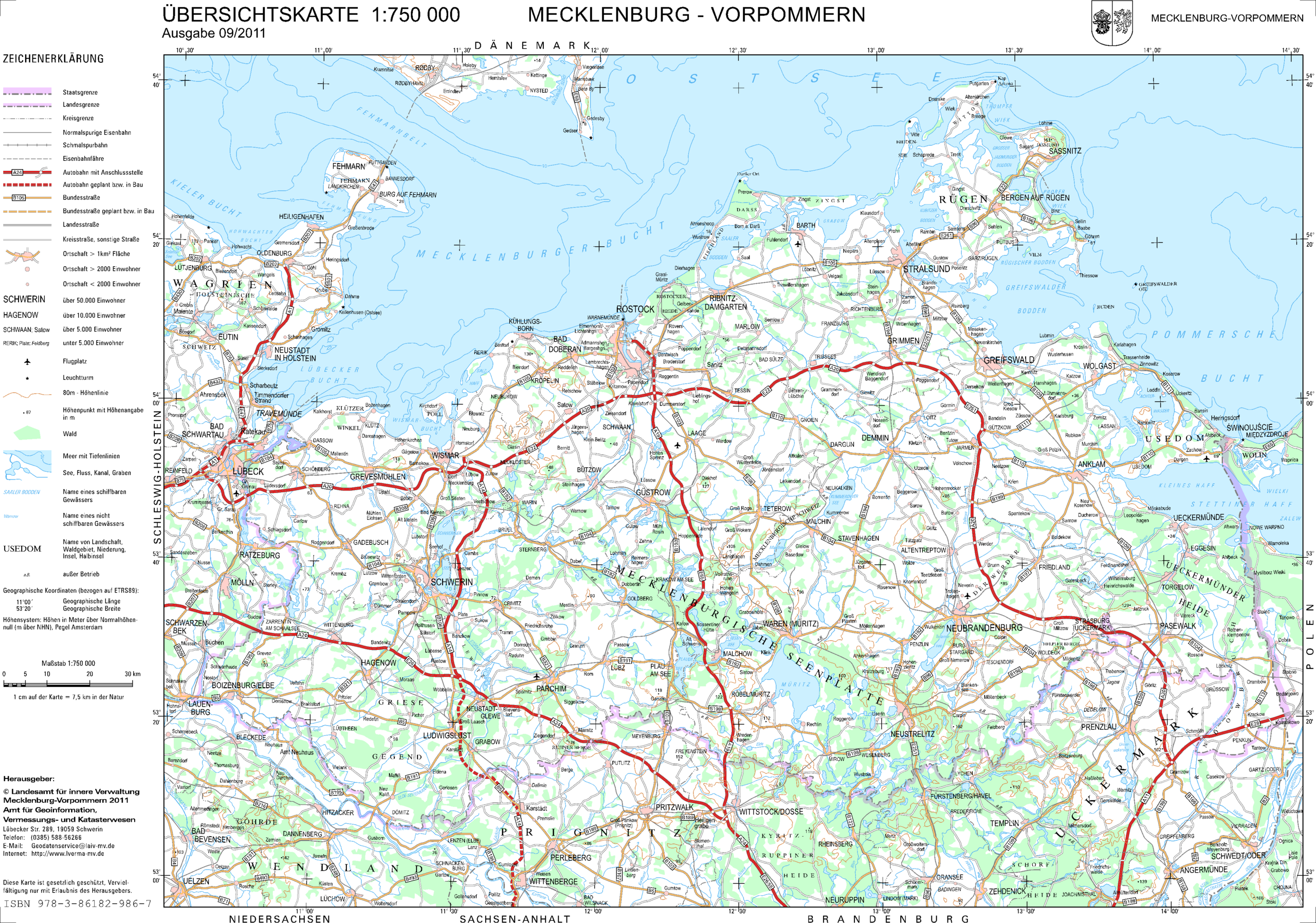
| Description |
Deutsch: Übersichtskarte von Mecklenburg-Vorpommern 1:750.000, Stand 09/2011
English: General map of Mecklenburg-Vorpommern 1:750.000 |
| Date | |
| Source | http://www.laiv-mv.de/land-mv/LAiV_prod/LAiV/AfGVK/_atkis/atkis_dtk_gebiet_750mv.jsp#Übersichtskarte |
| Author | Landesamt für innere Verwaltung Mecklenburg-Vorpommern, Amt für Geoinformation, Vermessungs- und Katasterwesen |
| Other versions |
_(cropped).png)
.png&action=edit§ion=1)
Licensing edit
.png&action=edit§ion=2)
This file is licensed under the Creative Commons Attribution 3.0 Germany license.
- You are free:
- to share – to copy, distribute and transmit the work
- to remix – to adapt the work
- Under the following conditions:
- attribution – You must give appropriate credit, provide a link to the license, and indicate if changes were made. You may do so in any reasonable manner, but not in any way that suggests the licensor endorses you or your use.

File history
Click on a date/time to view the file as it appeared at that time.
| Date/Time | Thumbnail | Dimensions | User | Comment | |
|---|---|---|---|---|---|
| current | 20:57, 23 May 2012 | | 4,090 × 2,870 (928 KB) | NordNordWest (talk | contribs) | == {{int:filedesc}} == {{Information |Description= {{de|Übersichtskarte von Mecklenburg-Vorpommern 1:750.000, Stand 09/2011}} {{en|General map of Mecklenburg-Vorpommern 1:750.000}} |Source=http://www.laiv-mv.de/land-mv/LAiV_prod/LAiV/AfGVK/_atkis/atk... |
You cannot overwrite this file.
File usage on Commons
The following page uses this file:
File usage on other wikis
The following other wikis use this file:
- Usage on de.wikipedia.org
.png&oldid=667364551)