File:Maçanet de Cabrenys 2011 33.jpg

Size of this preview: 798 × 599 pixels. Other resolutions: 320 × 240 pixels | 639 × 480 pixels | 1,023 × 768 pixels | 1,280 × 961 pixels | 2,560 × 1,923 pixels | 4,016 × 3,016 pixels.
Original file (4,016 × 3,016 pixels, file size: 4.57 MB, MIME type: image/jpeg)
Captions
Captions
Add a one-line explanation of what this file represents
Summary edit
| Description |
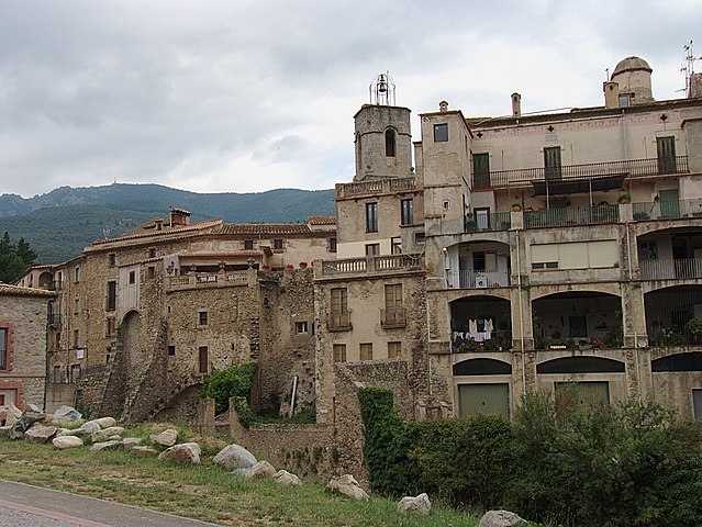
Français : Enceinte fortifiée de la ville et Can Molar depuis la rue du Pont, Maçanet de Cabrenys (Haut-Ampurdan, Gérone, Catalogne, Espagne)
Català: Recinte fortificat i Can Molar des del carrer del Pont, Maçanet de Cabrenys (Alt Empordà, Girona, Catalunya, Espanya)
Español: recinto fortificado y Can Molar desde la calle del Puente, Massanet de Cabrenys (Alto Ampurdán, Gerona, Cataluña, España)
|
||
| Date | |||
| Source | Own work | ||
| Author |
Bertrand GRONDIN |
| Camera location | | View this and other nearby images on: OpenStreetMap |
|---|
| Object location | | View this and other nearby images on: OpenStreetMap |
|---|
Licensing edit
I, the copyright holder of this work, hereby publish it under the following licenses:

|
Permission is granted to copy, distribute and/or modify this document under the terms of the GNU Free Documentation License, Version 1.2 or any later version published by the Free Software Foundation; with no Invariant Sections, no Front-Cover Texts, and no Back-Cover Texts. A copy of the license is included in the section entitled GNU Free Documentation License. |
This file is licensed under the Creative Commons Attribution-Share Alike 3.0 Unported, 2.5 Generic, 2.0 Generic and 1.0 Generic license.
- You are free:
- to share – to copy, distribute and transmit the work
- to remix – to adapt the work
- Under the following conditions:
- attribution – You must give appropriate credit, provide a link to the license, and indicate if changes were made. You may do so in any reasonable manner, but not in any way that suggests the licensor endorses you or your use.
- share alike – If you remix, transform, or build upon the material, you must distribute your contributions under the same or compatible license as the original.
You may select the license of your choice.
File history
Click on a date/time to view the file as it appeared at that time.
| Date/Time | Thumbnail | Dimensions | User | Comment | |
|---|---|---|---|---|---|
| current | 19:57, 18 August 2011 | | 4,016 × 3,016 (4.57 MB) | Grondin (talk | contribs) | {{Information |Description ={{fr|1=Can Molar depuis la rue du Pont, Maçanet de Cabrenys (Haut-Ampurdan, Gérone, Catalogne, Espagne)}} {{ca|1=Can Molar des del carrer del Pont, Maçanet de Cabrenys (Alt Empordà, Girona, Catalunya, Espanya)}} {{es|1=C |
You cannot overwrite this file.
File usage on Commons
The following 4 pages use this file:
File usage on other wikis
The following other wikis use this file:
- Usage on ar.wikipedia.org
- Usage on ca.wikipedia.org
- Usage on ca.wikiquote.org
- Usage on ce.wikipedia.org
- Usage on eu.wikipedia.org
- Usage on hu.wikipedia.org
- Usage on ia.wikipedia.org
- Usage on id.wikipedia.org
- Usage on lld.wikipedia.org
- Usage on lmo.wikipedia.org
- Usage on pt.wikipedia.org
- Usage on ru.wikipedia.org
- Usage on tt.wikipedia.org
- Usage on uz.wikipedia.org
- Usage on vec.wikipedia.org
- Usage on www.wikidata.org