File:Maastricht, Nieuwe Bossche Fronten, duiker in bastion B.JPG
Size of this preview: 431 × 599 pixels. Other resolutions: 173 × 240 pixels | 345 × 480 pixels | 552 × 768 pixels | 1,152 × 1,601 pixels.
Original file (1,152 × 1,601 pixels, file size: 865 KB, MIME type: image/jpeg)
Captions
Captions
Add a one-line explanation of what this file represents
Summary edit
| Description |
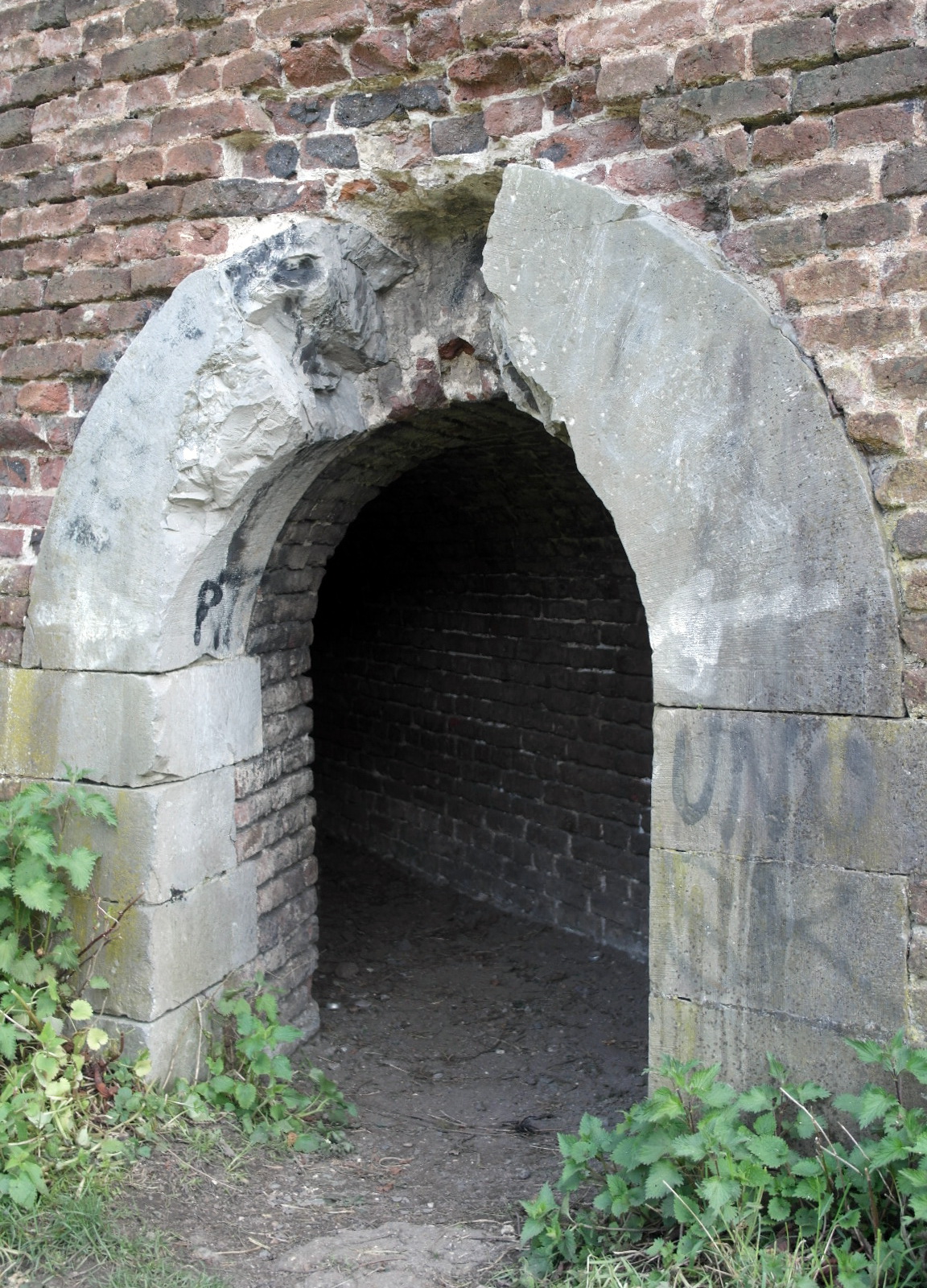
English: Frontenpark, Maastricht, the Netherlands. View of a culvert in Bastion B in the Nieuwe Bossche Fronten fortifications. The culvert was used to inundate this part of the fortifications. The water was led from the small river Jeker through the Jekerkanaal to this area. The keystone with the crowned letter W (of King William I) was removed by force by vandals, causing a lot of damage. |
| Date | |
| Source | Own work |
| Author | Kleon3 |
| Camera location | | View this and other nearby images on: OpenStreetMap |
|---|
Licensing edit
I, the copyright holder of this work, hereby publish it under the following license:
This file is licensed under the Creative Commons Attribution-Share Alike 4.0 International license.
- You are free:
- to share – to copy, distribute and transmit the work
- to remix – to adapt the work
- Under the following conditions:
- attribution – You must give appropriate credit, provide a link to the license, and indicate if changes were made. You may do so in any reasonable manner, but not in any way that suggests the licensor endorses you or your use.
- share alike – If you remix, transform, or build upon the material, you must distribute your contributions under the same or compatible license as the original.
File history
Click on a date/time to view the file as it appeared at that time.
| Date/Time | Thumbnail | Dimensions | User | Comment | |
|---|---|---|---|---|---|
| current | 16:50, 12 April 2016 | | 1,152 × 1,601 (865 KB) | Kleon3 (talk | contribs) | User created page with UploadWizard |
You cannot overwrite this file.
File usage on Commons
There are no pages that use this file.
File usage on other wikis
The following other wikis use this file:
- Usage on nl.wikipedia.org