File:Machapuchare.jpg

Size of this preview: 800 × 518 pixels. Other resolutions: 320 × 207 pixels | 640 × 414 pixels | 1,024 × 663 pixels | 1,187 × 768 pixels.
Original file (1,187 × 768 pixels, file size: 274 KB, MIME type: image/jpeg)
Captions
Captions
Add a one-line explanation of what this file represents
| Description |
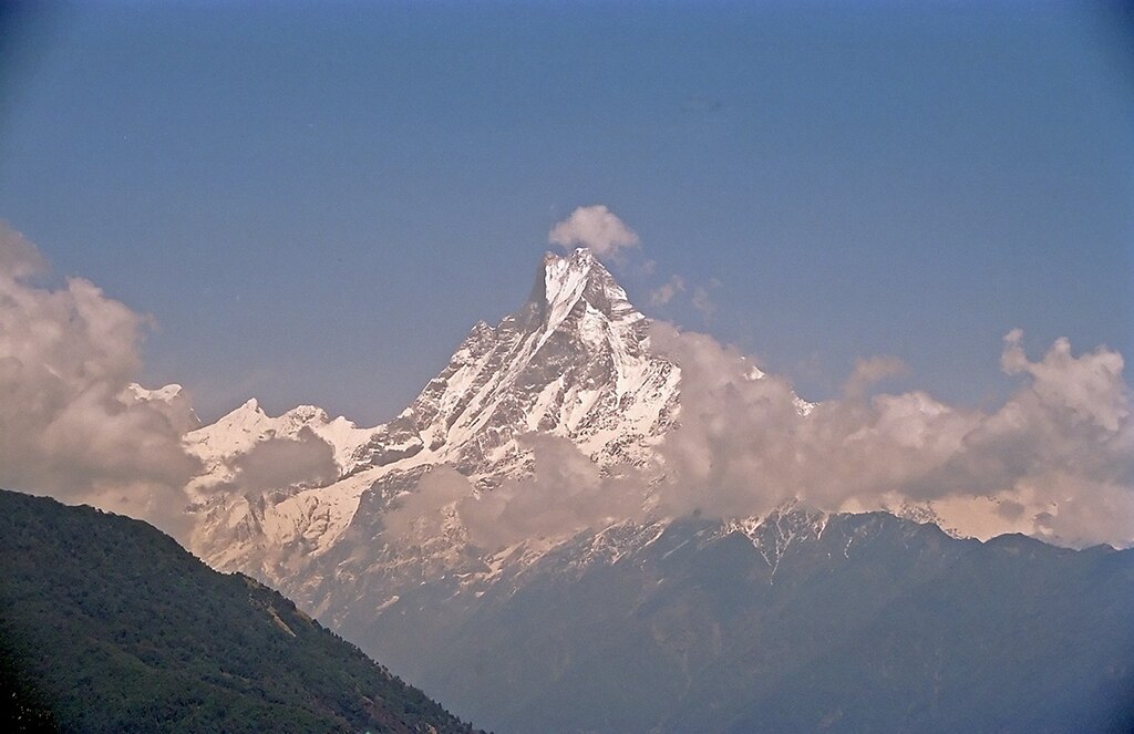
English: Machapucharé (7,000 m), Himalaya, Nepal |
| Date | |
| Source | Own work |
| Author | Kogo |
| Object location | | View this and other nearby images on: OpenStreetMap |
|---|
I, the copyright holder of this work, hereby publish it under the following licenses:
This file is licensed under the Creative Commons Attribution 2.0 Generic license.
- You are free:
- to share – to copy, distribute and transmit the work
- to remix – to adapt the work
- Under the following conditions:
- attribution – You must give appropriate credit, provide a link to the license, and indicate if changes were made. You may do so in any reasonable manner, but not in any way that suggests the licensor endorses you or your use.

|
Permission is granted to copy, distribute and/or modify this document under the terms of the GNU Free Documentation License, Version 1.2 or any later version published by the Free Software Foundation; with no Invariant Sections, no Front-Cover Texts, and no Back-Cover Texts. A copy of the license is included in the section entitled GNU Free Documentation License. |
You may select the license of your choice.
This image was selected as picture of the day on Wikimedia Commons for 9 May 2005. It was captioned as follows: Other languages:
Cymraeg: Mynydd Machapucharé yn yr Himalaya Slovenščina: Machapucharé (ribji rep) je s svojimi 7000 m ena najlepših gora Himalajskega grebena Anapurne. Suomi: Seitsemän kilometriä korkea Machapucharé-vuoren huippu Himalajalla ગુજરાતી : હિમાલયનું માચાપુચારે શિખર |
File history
Click on a date/time to view the file as it appeared at that time.
| Date/Time | Thumbnail | Dimensions | User | Comment | |
|---|---|---|---|---|---|
| current | 20:57, 14 March 2005 | | 1,187 × 768 (274 KB) | Kogo (talk | contribs) | Machapucharé |
You cannot overwrite this file.
File usage on Commons
The following 29 pages use this file:
- Machhapuchchhre
- Commons:Potd/2005-05 (fr)
- Commons:Potd/2005-05 (pl)
- Commons:Potd/2005-05 (pt)
- Commons:Potd/2005-05 (tr)
- Template:Potd/2005-05
- Template:Potd/2005-05-09
- Template:Potd/2005-05-09 (ang)
- Template:Potd/2005-05-09 (ast)
- Template:Potd/2005-05-09 (be)
- Template:Potd/2005-05-09 (ca)
- Template:Potd/2005-05-09 (cs)
- Template:Potd/2005-05-09 (cy)
- Template:Potd/2005-05-09 (de)
- Template:Potd/2005-05-09 (en)
- Template:Potd/2005-05-09 (es)
- Template:Potd/2005-05-09 (fi)
- Template:Potd/2005-05-09 (fr)
- Template:Potd/2005-05-09 (gu)
- Template:Potd/2005-05-09 (it)
- Template:Potd/2005-05-09 (ja)
- Template:Potd/2005-05-09 (ko)
- Template:Potd/2005-05-09 (nan)
- Template:Potd/2005-05-09 (ru)
- Template:Potd/2005-05-09 (sk)
- Template:Potd/2005-05-09 (sl)
- Template:Potd/2005-05-09 (th)
- Template:Potd/2005-05-09 (zh-hans)
- Template:Potd/2005-05-09 (zh-hant)
File usage on other wikis
The following other wikis use this file:
- Usage on en.wikipedia.org
- Usage on fr.wikipedia.org
- Usage on ia.wikipedia.org
- Usage on it.wikipedia.org
- Usage on ja.wikipedia.org
- Usage on jv.wikipedia.org
- Usage on ko.wikipedia.org
- Usage on pl.wikipedia.org
- Usage on pnb.wikipedia.org
- Usage on pt.wikipedia.org
- Usage on ru.wikipedia.org
- Usage on ru.wikinews.org
- Usage on ta.wikipedia.org
- Usage on uk.wikipedia.org