File:Manju and Kanju islands 201705.jpg

Size of this preview: 800 × 448 pixels. Other resolutions: 320 × 179 pixels | 640 × 359 pixels | 1,024 × 574 pixels | 1,280 × 717 pixels | 3,568 × 2,000 pixels.
Original file (3,568 × 2,000 pixels, file size: 1.31 MB, MIME type: image/jpeg)
Captions
Captions
Add a one-line explanation of what this file represents
Summary edit
| Description |
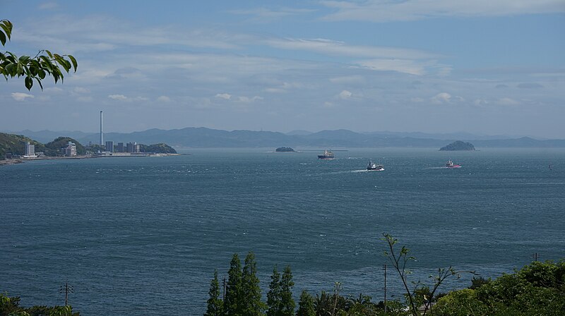
日本語: 和布刈から北東の眺め。ふたつの島は右側が満珠(まんじゅ)、左側が干珠(かんじゅ)で、下関市長府にある忌宮神社の飛び地境内となっている。写真左端付近の煙突は中国電力下関発電所。2017年5月撮影。
English: A view from Mekari, Kitakyushu-city, Fukuoka prefecture, toward the east entrance of Kanmon straits. Two islets are called Manju and Kanju, the precincts of Iminomiya shrine. |
| Date | |
| Source | Own work |
| Author | Ka23 13 |
| Camera location | | View this and other nearby images on: OpenStreetMap |
|---|
Licensing edit
I, the copyright holder of this work, hereby publish it under the following license:
This file is licensed under the Creative Commons Attribution-Share Alike 4.0 International license.
- You are free:
- to share – to copy, distribute and transmit the work
- to remix – to adapt the work
- Under the following conditions:
- attribution – You must give appropriate credit, provide a link to the license, and indicate if changes were made. You may do so in any reasonable manner, but not in any way that suggests the licensor endorses you or your use.
- share alike – If you remix, transform, or build upon the material, you must distribute your contributions under the same or compatible license as the original.
File history
Click on a date/time to view the file as it appeared at that time.
| Date/Time | Thumbnail | Dimensions | User | Comment | |
|---|---|---|---|---|---|
| current | 10:35, 7 May 2017 | | 3,568 × 2,000 (1.31 MB) | Ka23 13 (talk | contribs) | User created page with UploadWizard |
You cannot overwrite this file.
File usage on Commons
There are no pages that use this file.
File usage on other wikis
The following other wikis use this file: