File:Map-DR-Brunswick.svg

Size of this PNG preview of this SVG file: 707 × 600 pixels. Other resolutions: 283 × 240 pixels | 566 × 480 pixels | 905 × 768 pixels | 1,207 × 1,024 pixels | 2,414 × 2,048 pixels | 2,621 × 2,224 pixels.
Original file (SVG file, nominally 2,621 × 2,224 pixels, file size: 712 KB)
Captions
Captions
Add a one-line explanation of what this file represents
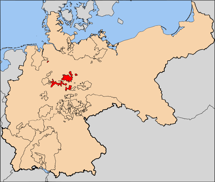
| Description | The Duchy of Brunswick (Herzogtum Braunschweig) within the German Empire |
| Date | |
| Source | Based on map data of the IEG-Maps project (Andreas Kunz, B. Johnen and Joachim Robert Moeschl: University of Mainz) - http://www.ieg-maps.uni-mainz.de |
| Author | User:52 Pickup |
| Permission (Reusing this file) |
This file is licensed under the Creative Commons Attribution-Share Alike 2.5 Generic license.
|
File history
Click on a date/time to view the file as it appeared at that time.
| Date/Time | Thumbnail | Dimensions | User | Comment | |
|---|---|---|---|---|---|
| current | 14:04, 26 January 2007 | | 2,621 × 2,224 (712 KB) | 52 Pickup (talk | contribs) | {{Information| |Description= The Duchy of Brunswick (Herzogtum Braunschweig) within the German Empire |Source= Based on map data of the IEG-Maps project (Andreas Kunz, B. Johne |
You cannot overwrite this file.
File usage on Commons
The following page uses this file:
File usage on other wikis
The following other wikis use this file:
- Usage on azb.wikipedia.org
- Usage on de.wikipedia.org
- Usage on en.wikipedia.org