File:Map 20110815 ap cd 4 certified.pdf
Original file (1,275 × 1,650 pixels, file size: 1.26 MB, MIME type: application/pdf)
Captions
Captions
| Description |
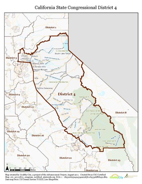
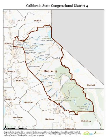
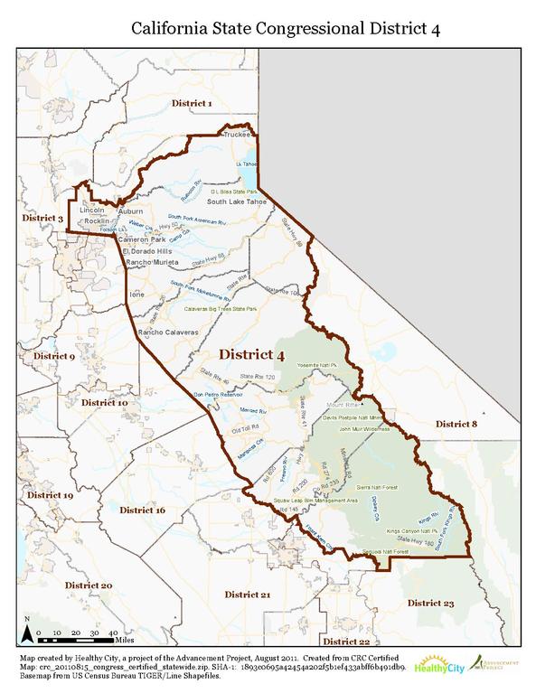
English: Boundaries for California's 4th congressional district — encompasses the Sierra Nevada from Truckee south to the Sequoia National Forest.
|
|||
| Date | ||||
| Source | http://wedrawthelines.ca.gov/maps-final-draft-congressional-districts.html | |||
| Author | Healthy City, a project of the Advancement Project | |||
| Permission (Reusing this file) |
|

File history
Click on a date/time to view the file as it appeared at that time.
| Date/Time | Thumbnail | Dimensions | User | Comment | |
|---|---|---|---|---|---|
| current | 03:53, 24 February 2013 |  | 1,275 × 1,650 (1.26 MB) | Stepheng3 (talk | contribs) | {{Information |Description ={{en|1=A map of CA-04 congressional district in 2013.}} |Source =http://wedrawthelines.ca.gov/maps-final-draft-congressional-districts.html |Author =Healthy City, a project of the Advancement Project |Date... |
You cannot overwrite this file.
File usage on Commons
There are no pages that use this file.
File usage on other wikis
The following other wikis use this file:
- Usage on es.wikipedia.org
- Usage on fa.wikipedia.org
- Usage on nl.wikipedia.org